I'm back again, with my memories and reflections of my remaining days hiking the PCT through Oregon. I've been finding that as I get closer and closer to the end, my memory is a lot sharper and the details feel a lot more important. The days in the desert blurred together and now only certain memories stick out at me, but in the latter half of my hike, each day had special moments and feelings, and each experience felt important and significant. So, as a result, this post is ridiculously long and I can't be bothered to try to split it into more posts, so if you're still there, reader, well... good luck. Ultimately I'm writing this mainly for myself anyway!
😊
As I mentioned in last post, I recommend viewing this on Google Chrome or your phone, the photos do not upload well on Internet Explorer!

Anyway, I left off spending a night between two beautiful lakes, still keeping up with my trail partner, Macro, and although dealing with some challenging emotional conflicts, continuing to truck ahead with my sights set on the northern terminus.
 |
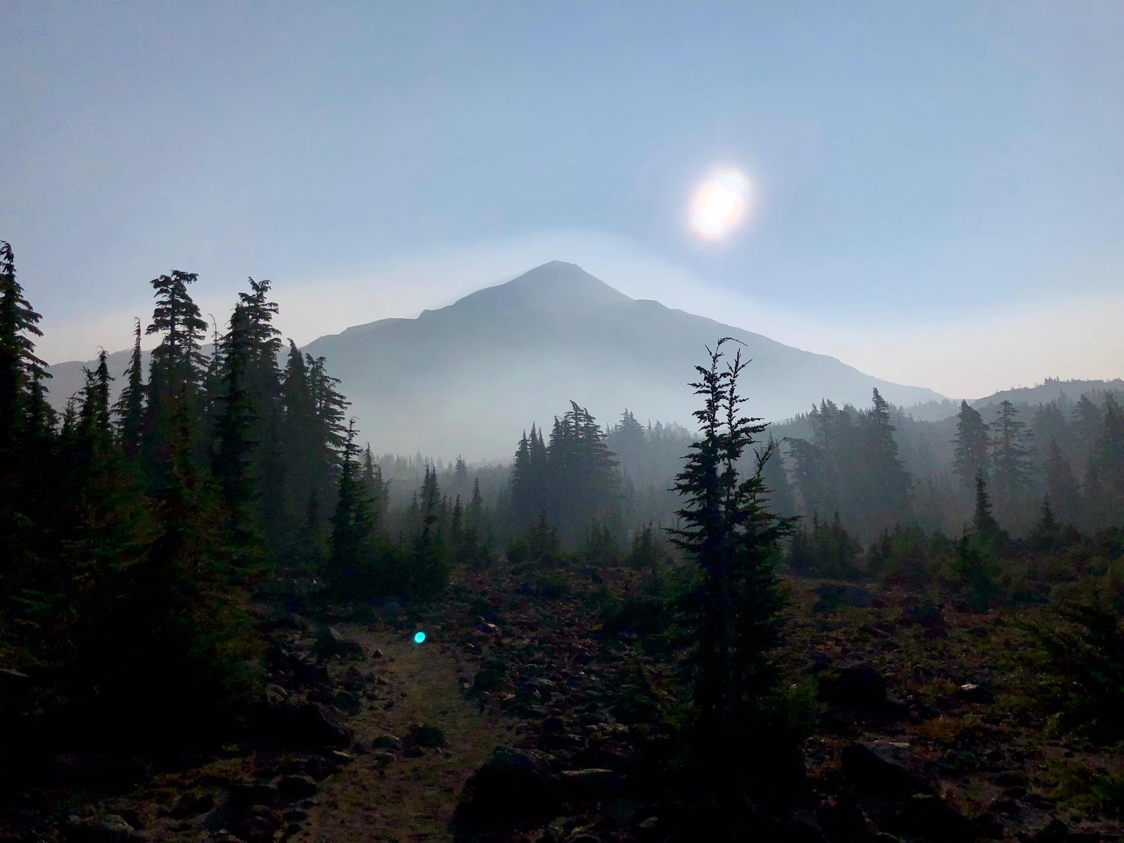
| Smoky sunrise just outside of Three Sisters Wilderness |
The next day we officially entered the Three Sisters Wilderness, camping next to a small pond, where I spent a peaceful evening eating a delicious Knorr pasta side (I ate one almost every night and honestly never got sick of them), watching a collection of bats hunting insects above my head, and forcing Macro to listen to me belting the Hercules soundtrack for the hundredth time (I could
not get it out of my head for a month straight). The next morning Macro and I decided to meet at the end of the day at a campsite about 25 miles out, and then I headed on my way. At one point I discovered some phone service on a smoky ridge-top and ended up having a very long (3+ hours) phone call with my partner. By the time I hung up, it was already 5pm and I still had 6 miles to go (which ended up turning into 9 miles, because the water source we had planned to camp at was DRY!) It was starting to get darker earlier these days, (it was the end of August by this point), so I was certainly feeling some anxiety about how late I would end up at the site. In the end though, it was a fast and enjoyable 3 hours of hiking (likely facilitated by the fact that the phone call had ended on a good note, so I was feeling hopeful and positive, despite my worry at the late hour). The trail traveled through relatively flat terrain directly along the base of the South and Middle Sisters, which was beautiful and unique, even with the thick smoke obscuring most of the view. I stopped a few times just to take in the vast, weirdly apocalyptic sight. I felt physically strong and confident, and also really happy and engrossed in the landscape around me. The miles flew by, until I finally arrived at a campsite Macro had found, beside some huge rocks and an exposed, aqua blue pond. It was a beautiful, eerie spot. The sky was darkening, it was extremely windy, and there was a very cold bite to the air. Putting up my tent was a whole process, and then thanks to the wind I had to cook in my tent vestibule and eat inside the tent as it whipped loudly around me. Due to my late arrival (around 8pm), it was a later night than usual.
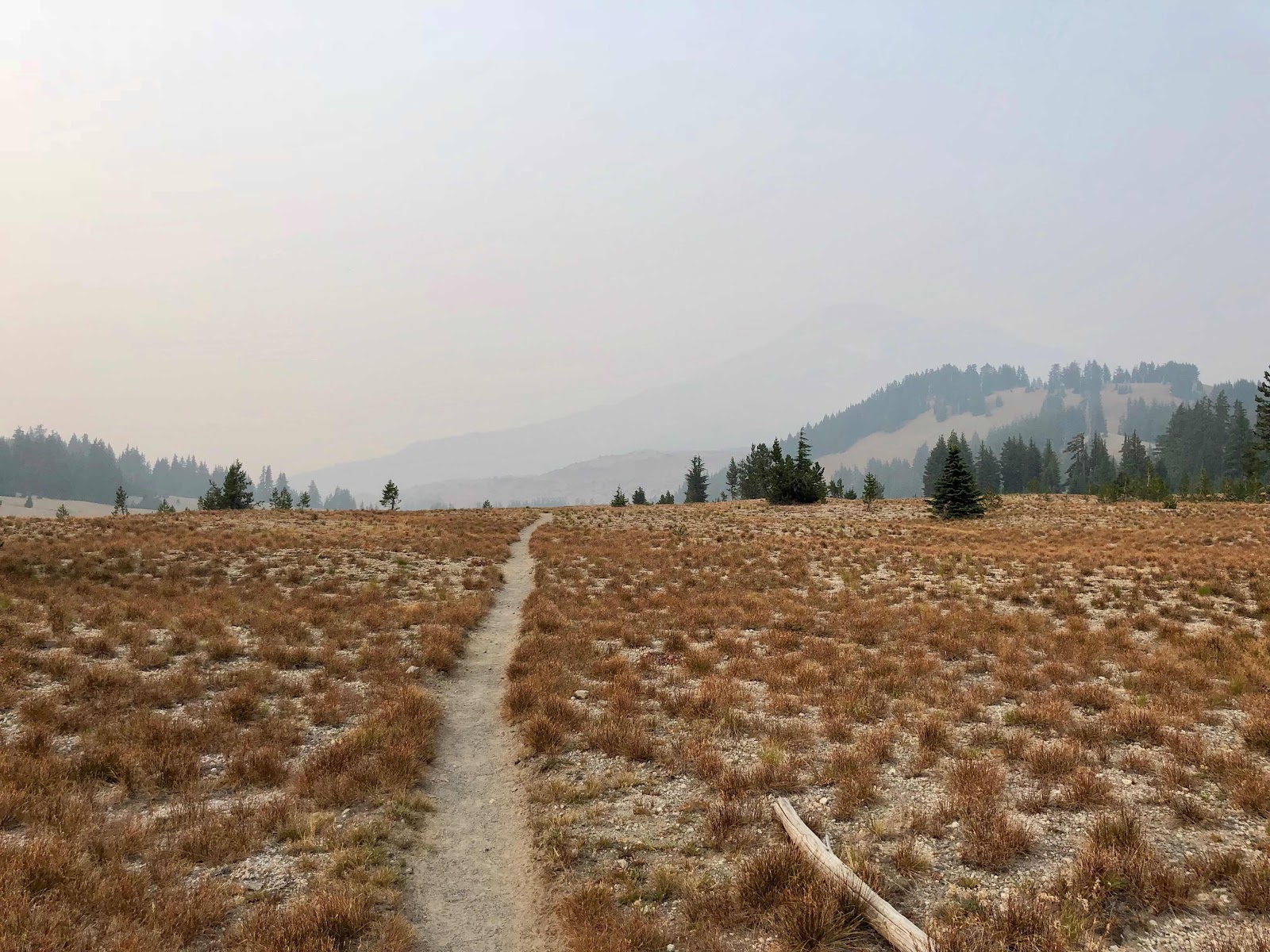 |
| This field with the almost hidden mountain in the distance felt apocalyptic. There was nothing and no one to see for miles, thanks to the pink-grey smoke sitting in the air. |
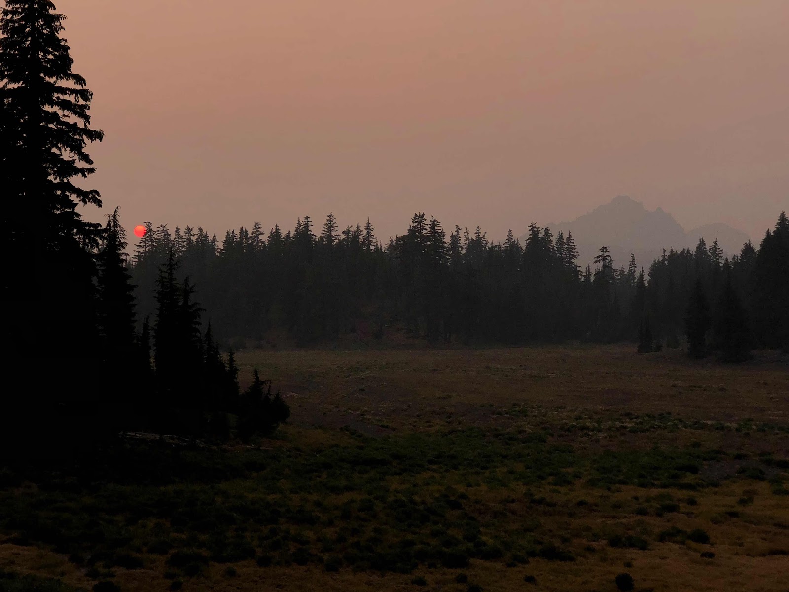 |
A dark red sunset as I walked the last few miles to camp. The smoke often resulted in a deep red sun that was both beautiful and pretty alarming. Definitely added to that apocalypse feel!
|
|
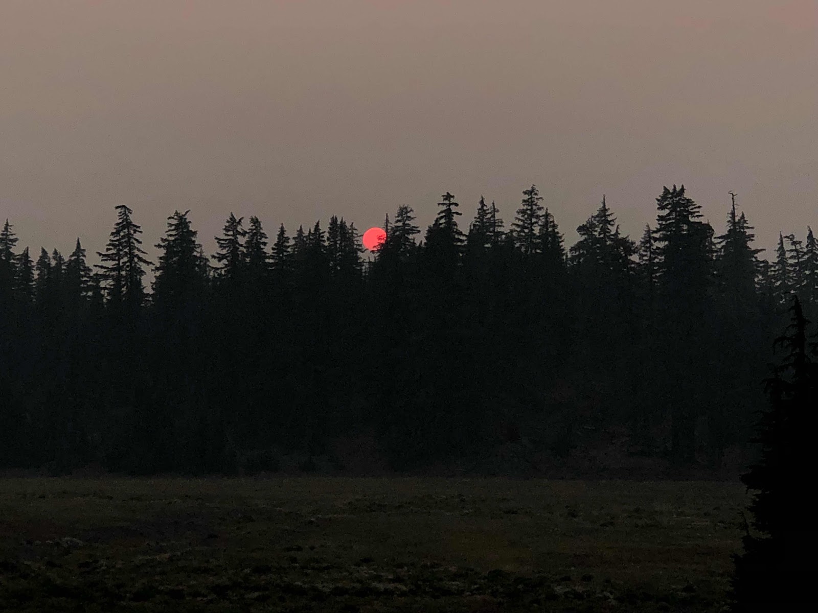 |
That red ball is the sun!
|
|
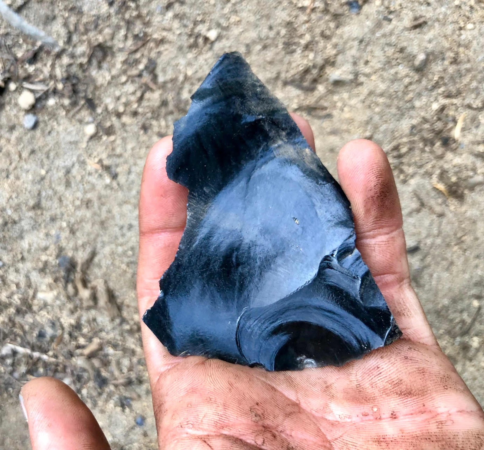
The next morning I woke up with a full-on beach inside my tent, because there had been sand blowing in all night - a thick layer of sand all over the tent floor; sand all over my sleeping bag, hair, and clothes; and a considerable amount of sand in my mouth... it was crunchy. The rest of the day I enjoyed some more beautiful views of the Sisters, lit up by the bright sun and thick smoke. The smoke cleared on one side of the sky around the time I arrived at Obsidian Falls for my morning snack, allowing me to see the falls backed by blue skies. The Obsidian Limited Entry Area in Three Sisters Wilderness is a section of the trail in which the landscape is punctuated by more recent lava flows and obsidian cliffs, leaving massive rocks and ridges of shiny obsidian and a wide range of sizes of obsidian shards all over the area. Obsidian is formed when lava dries very quickly, limiting the time needed for crystallization to form, resulting in shiny, black, volcanic glass, that naturally breaks off into sharp and creative shapes. It's been historically used by America's First Peoples for a variety of tools, including the well-known arrowheads found throughout the country. I was ridiculously excited about the obsidian all over the place in that area. I had a hard time not picking up
every rock I saw. It seemed like it would be an ideal place to defeat an army of White Walkers
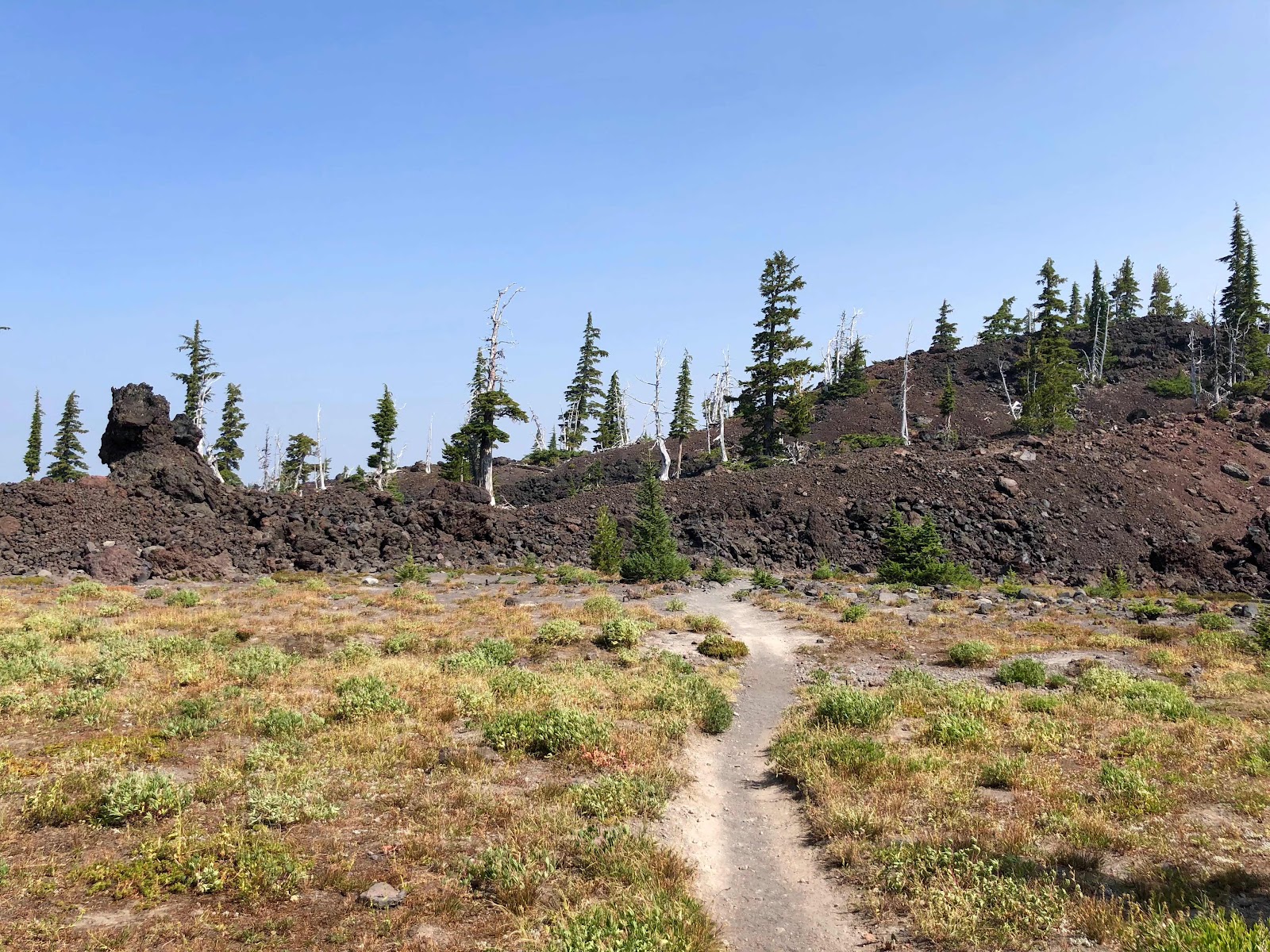 |
| About to head onto the first of many lava fields. |
 |
| The White Tree of Gondor |
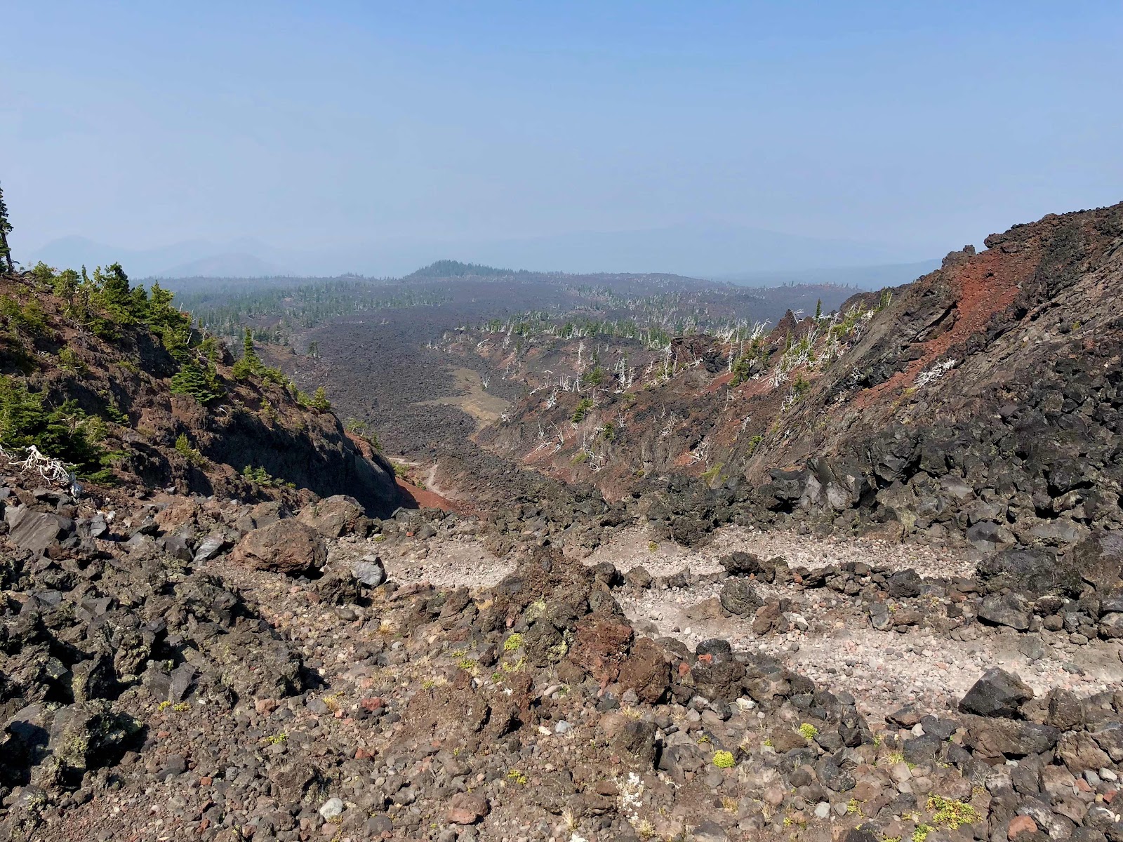 |
| Lava fields for miles |
 |
| The spectacular view behind me as a I walked away from the Three Sisters |
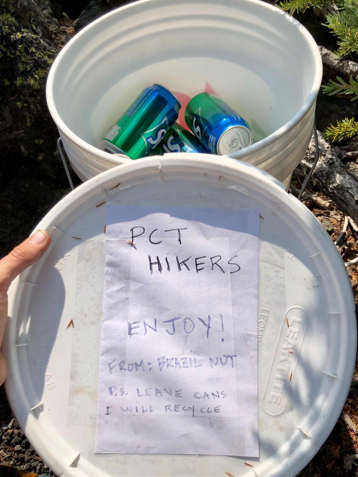 |
| Some simple and amazing trail magic from a fellow hiker. Such a treat! |
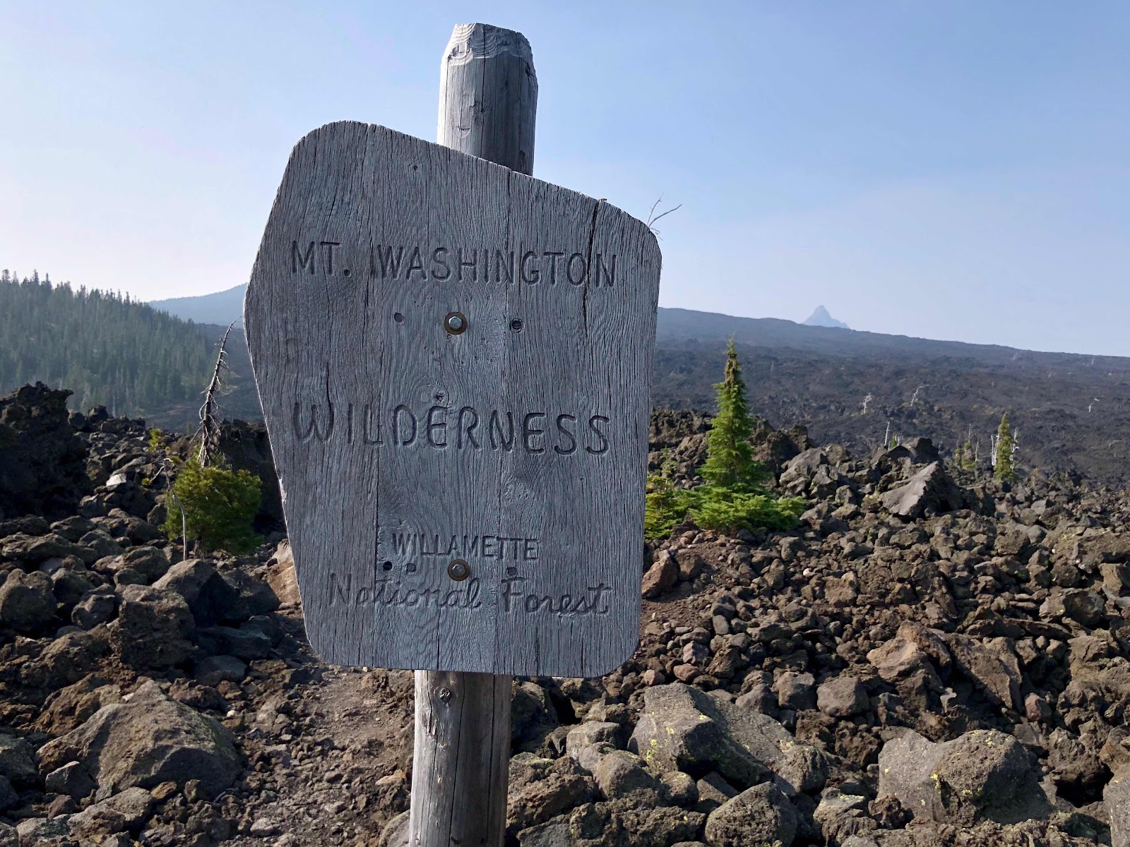 |
| Onto another huge lava field, heading towards Mt. Washington, that tiny peak in the distance. |
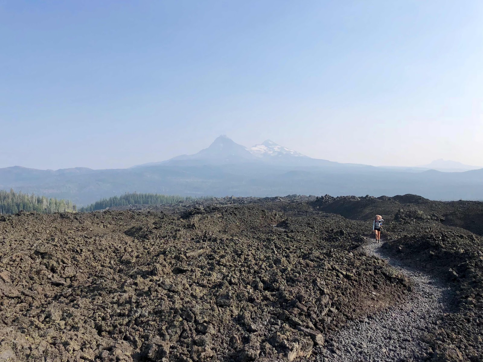 |
| My new friend, Coconut, with the Three Sisters behind her |
 |
I loved how I could actually see here how the lava flowed onto the ground beneath it.
|
|
 |
| Getting closer to Mt. Washington! |
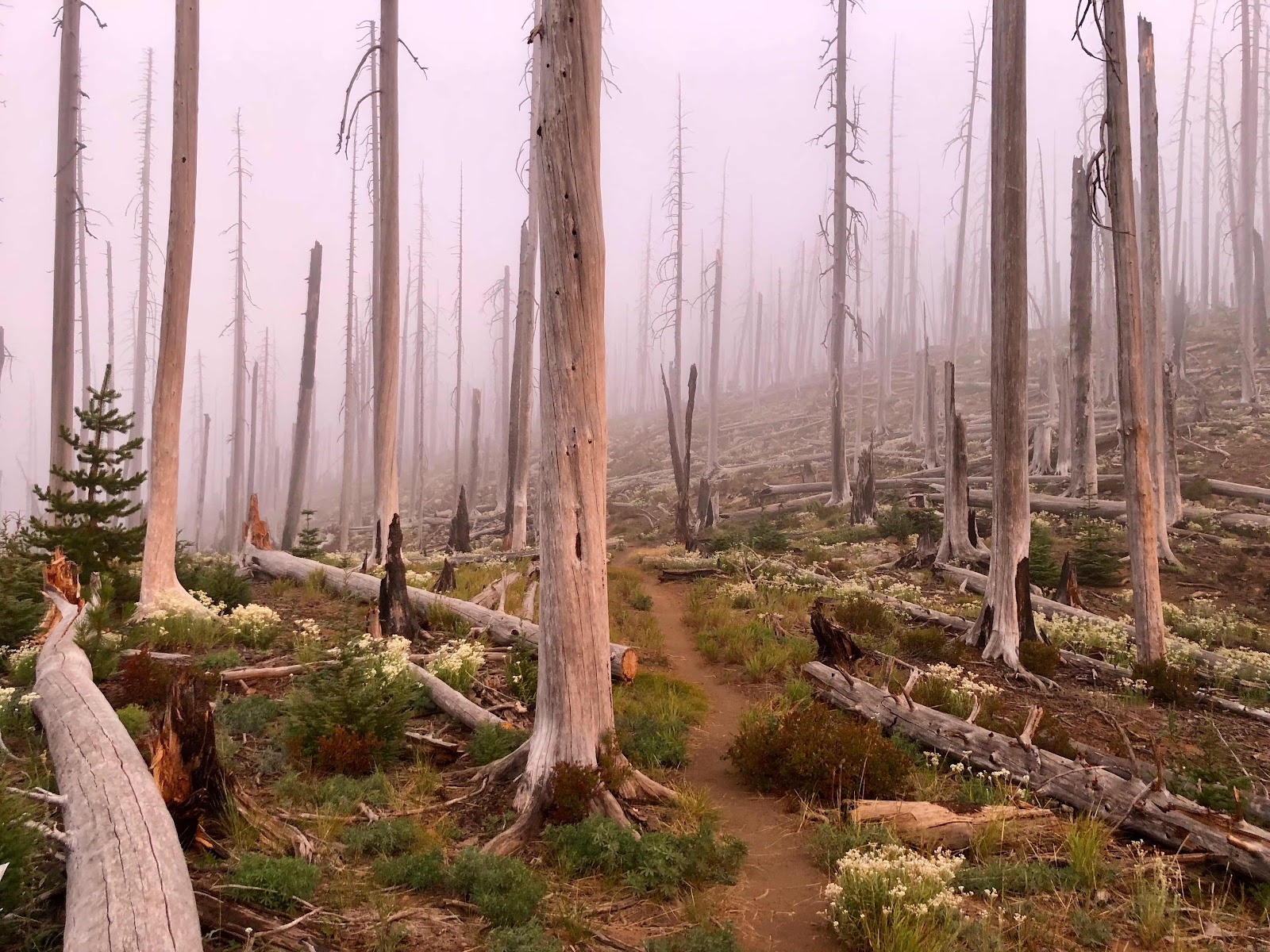
After walking off the lava field, I entered an older burn area. The dead trees had been completely sun bleached and the ground was strewn with pumice boulders and flowers. The sun, low in the sky, was lighting up the trees and flowers with a warm glow, the flowers stood out in striking contrast to the white trees, and the uniquely colourful, jagged peak of Mount Washington was slowly coming closer and closer... I felt such contentedness and pure joy as I travelled along the trail, to a cozy campsite nestled in the trees, with Mt. Washington's peak rising just above me. The wind blew relentlessly around my tent all night, and I again woke up with a thick layer of dusty sand in my tent and on my sleeping bag, but I was in beautiful, wild country, and I was grateful to be there.
 |
The light in the evening was often the most beautiful, so warm, soft, and pink
|
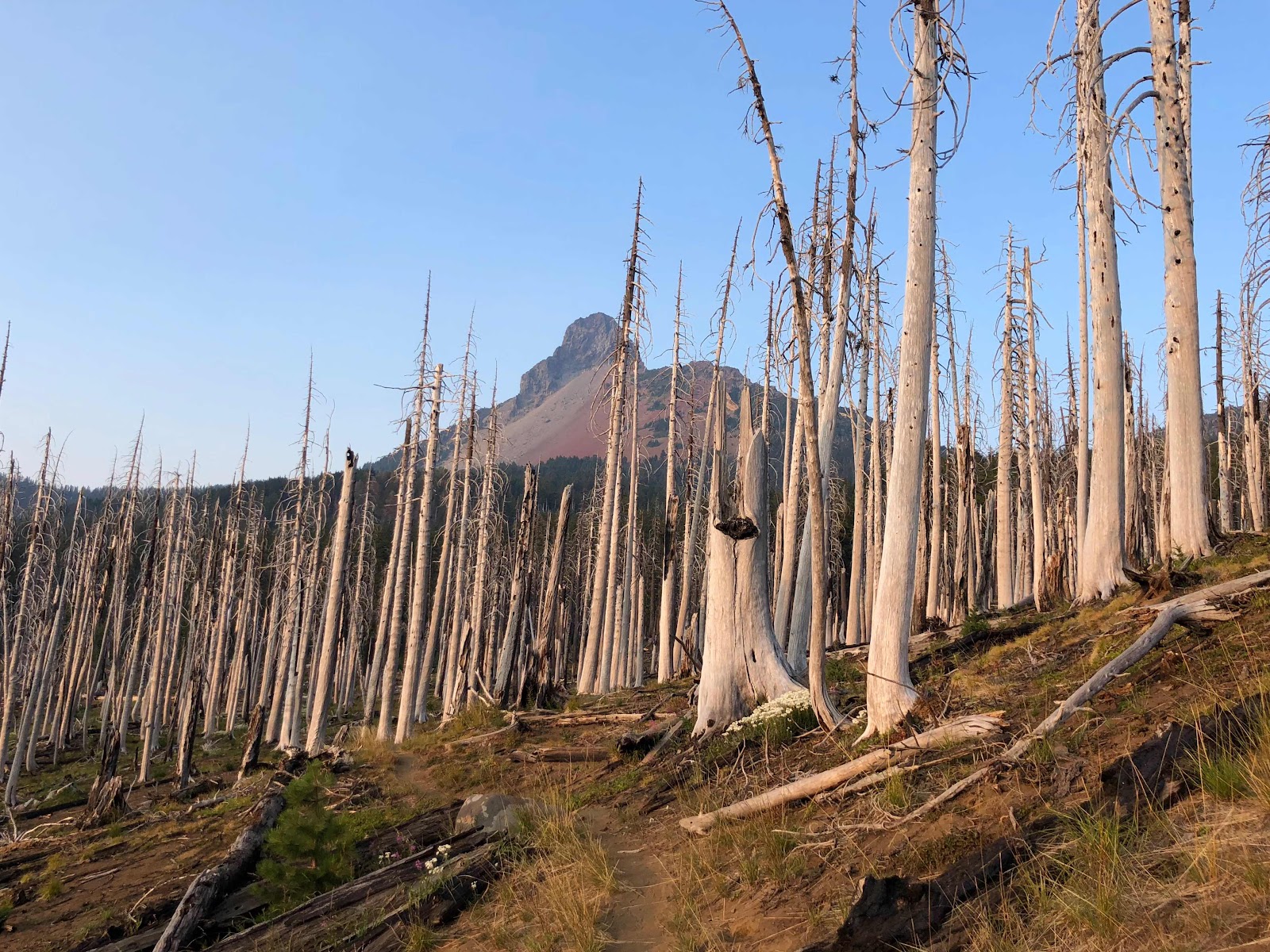 |
Mt. Washington's red side and one of the prettier burn areas I hiked through.
|
|
 |
How my belt pack looked by the end of the day. It's not exactly ultralight but the rock nerd in me couldn't let them go.
|
|
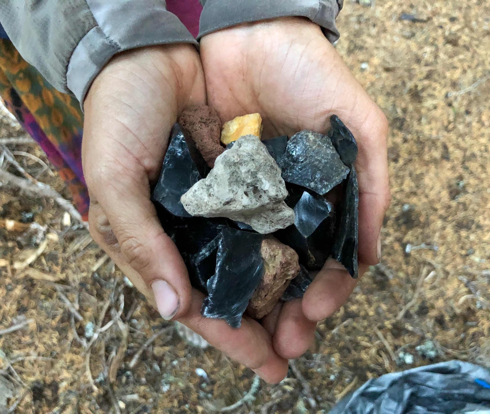 |
Showing off my haul (don't worry I mailed them home to myself before Washington)
|
|
In reflection, my last week or so in Oregon was actually so wonderful. Perhaps it was realizing that I was nearing the state line, so the end was in sight, or the fact that the smoke was getting more variable, or maybe just that the landscape was really very beautiful, but I was feeling very appreciative of where I was and what I was doing.
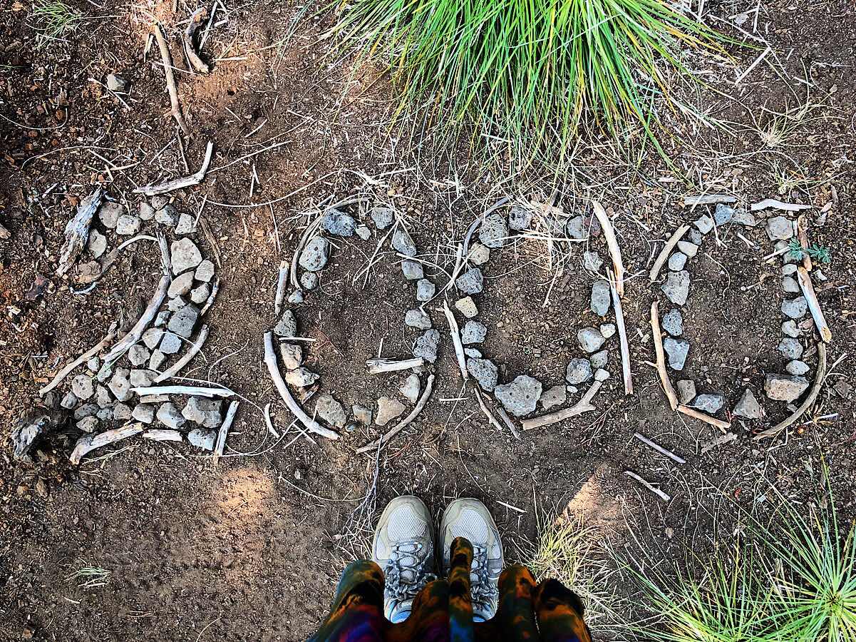
After leaving Mt. Washington, Macro and I headed into town for a resupply, after having had a full week since stopping for food and showers. We passed the very exciting 2000 mile marker along the way, hitched into Sisters, a cute little Western-themed town, and found a hotel room to spend the night in a bed. Surprisingly, by this point I was less excited about beds and showers as I had been earlier in the hike. My sleep pad and sleeping bag had become very cozy to me, and I no longer found it hard to not be able to sleep in my usual positions or to wake up every time I needed to turn around. At this point town was more so an exciting opportunity to get delicious food and then stay in a prone position for an extended period of time. Sitting in stillness was still pure bliss.
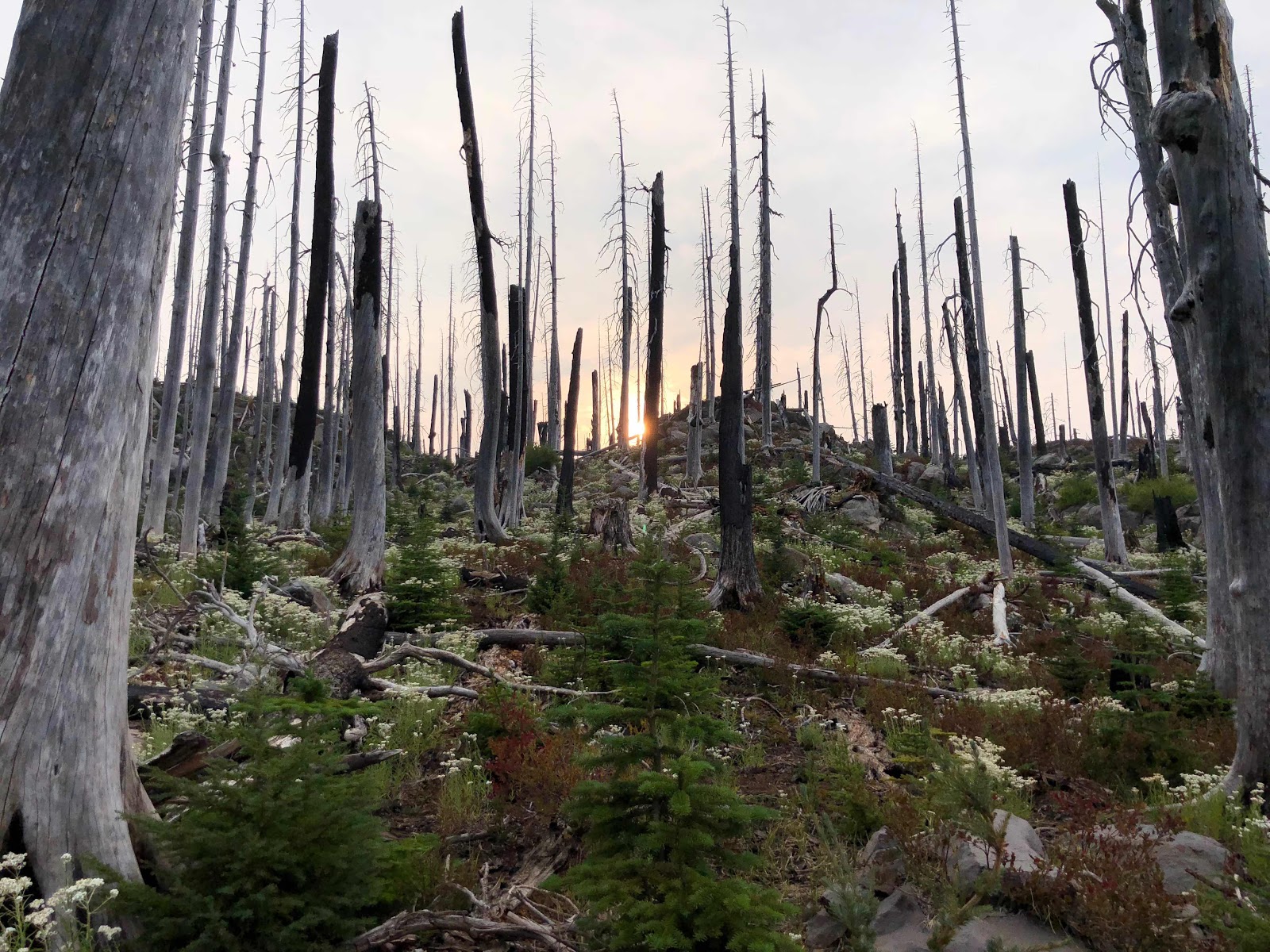
We left Sisters the next morning and continued about our way. It was a tired 10 miles to the campsite, but memorable nonetheless. We circled around the peak of Three Fingered Jack and spotted a herd of mountain goats. Jack was pretty spectacular, although still hazy in the smoke. The absolute highlight of the day was settling into an interesting campsite in the middle of a burn area, surrounded by rocks, charred trees, and flowers next to a shallow pond, while a spectacular sunset illuminated the sky and the wind blew all the smoke out of the air and I breathed in deeply of the clear, clean air. It's hard to find words to describe the serenity and fulfillment of moments like those.
 |
Mountain goats! (Possibly sheep? It was pretty hard to tell... everyone disagrees with me, but I still maintain they look like polar bears)
|
|
 |
The spectacular view walking away from Three Fingered Jack. The smoke didn't allow for a good picture but the colours of the rock were so bright in person!
|
|
 |
| More of soft, evening light and pretty flowers |
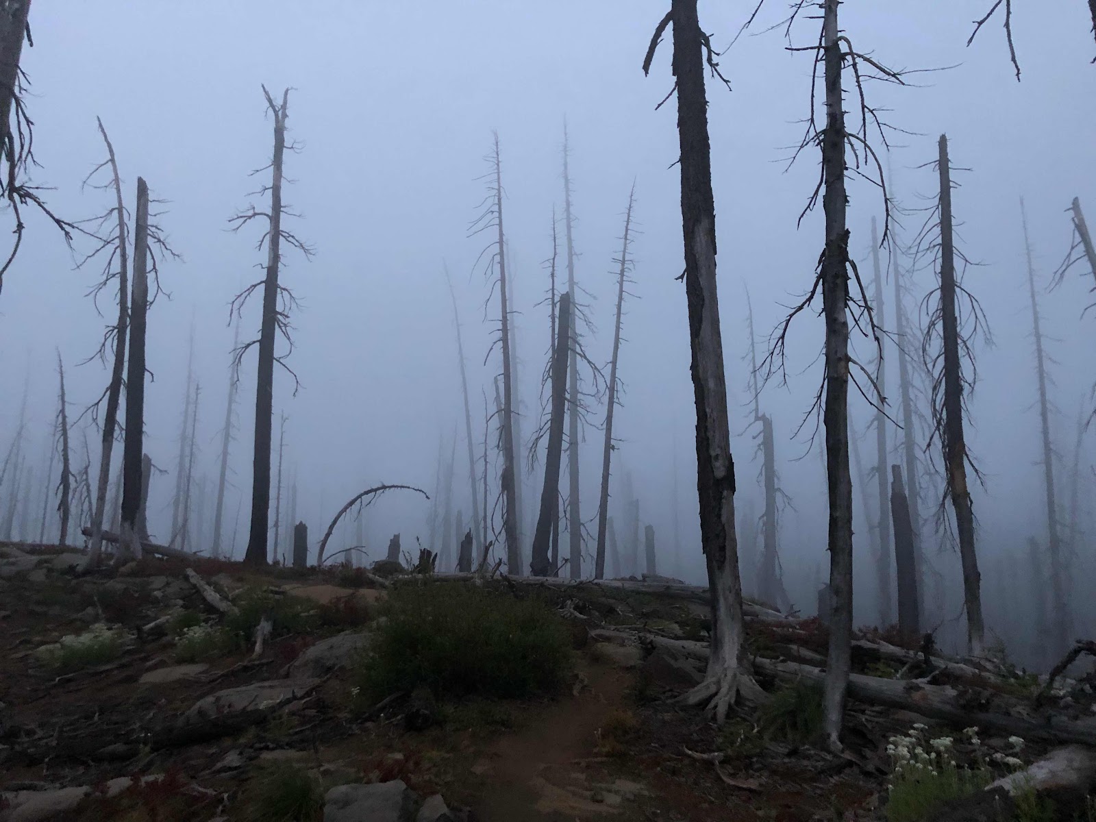
The next day is one of the days that has been seared into my memory with so much clarity. It was a good, special day from beginning to end. I have labelled it since as "Dead Horse Day", which doesn't sound entirely pleasant (and that part actually wasn't very pleasant), but it was a magical day nonetheless. It's hard to explain a lot of the magic and joy of the hike because there aren't words able to capture the feelings. A lot of the time the most precious moments for me were an ineffable combination of the state of mind I was in, the appearance of the scenery, the energy or "vibe" of the environment, and, I think, a spiritual presence that isn't really meant to be described or captured.
The background info on the name of this day is that a few weeks back I was skimming ahead on my GPS app looking at our upcoming days of hiking and discovered in the comments under one of the marked river crossings, Russell Creek, that there was a dead horse in the river. I was vaguely horrified, but assumed it would be gone by the time I got there and moved on. A few mornings before Dead Horse Day, I learned from more recent comments that the horse was still there, and by this point rather decomposed and smelly. I had been dreading it for a few days now, wondering how smelly it would be, how much effort the river crossing would take, and how horrified I would feel... I dislike the sadness of dead animals
and the grossness of a smelly, decomposing carcass, so I wasn't looking forward to it. As a result, although DHD was a super amazing day, I now also have a weird, creepy vibe associated with the Mount Jefferson Wilderness, because I spent 3/4 of the day freaking out about a dead horse.
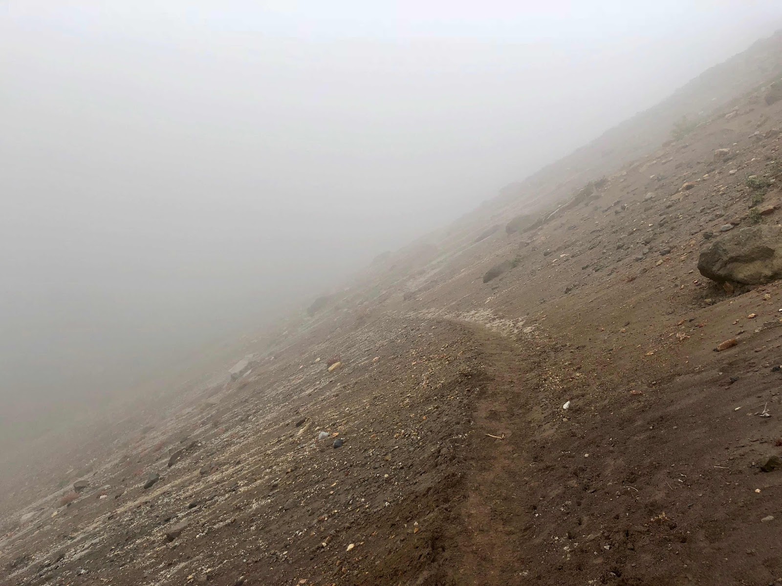
It started when I woke up at my usual 4:30am, inside a cloud. The air was wet and foggy, and as I started walking in the dark, I could only see a few feet ahead of me. Remarkably though, the fog had replaced the smoke, and for the first time in
weeks, as I hiked I was able to breathe in clean, damp air, and smell moist earth and fresh plants instead of burning wood smoke. As the light increased, the scenery appeared otherworldly with the fog rolling around the rocks and dead trees. When the sun finally peeked out from behind a nearby mountain, it illuminated the fog in a fiery explosion of red light, resulting in one of the most spectacular sunrises of my hike. The air was smoke free, the sun was warm, the ground was soft, and life was good.
 |
I stopped to get some pics at first light because I was so excited to see fog instead of smoke
|
|
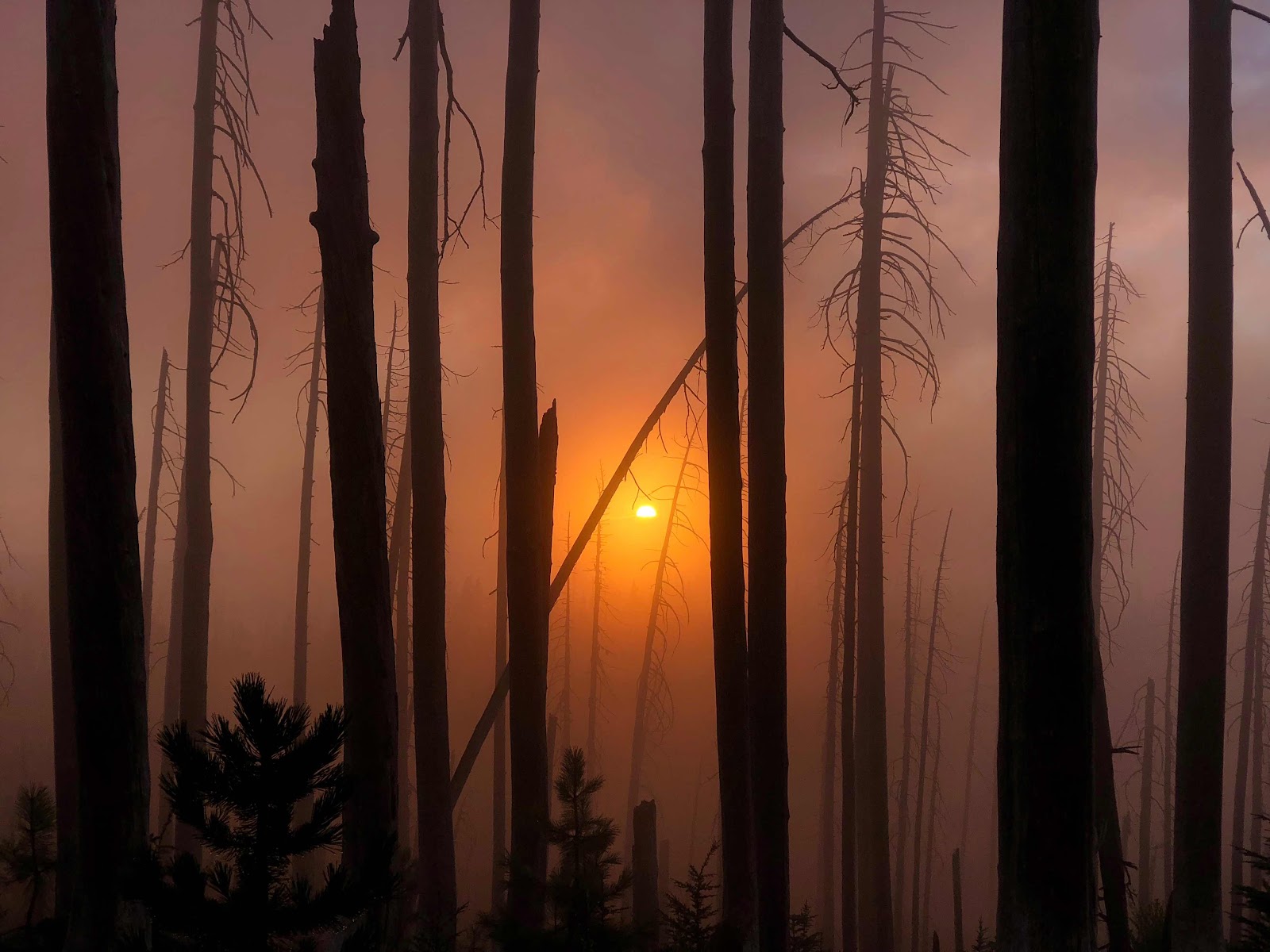 |
I've never seen a sunrise so spectacular as the way the sun lit the fog on fire as it peeked out from below a mountain across the valley.
|
|


 |
In a few seconds the fog started lifting and the trail was illuminated in that beautiful pink glow
|
 |
| I was so utterly joyful and content in this moment, it makes me tear up just thinking about it. |
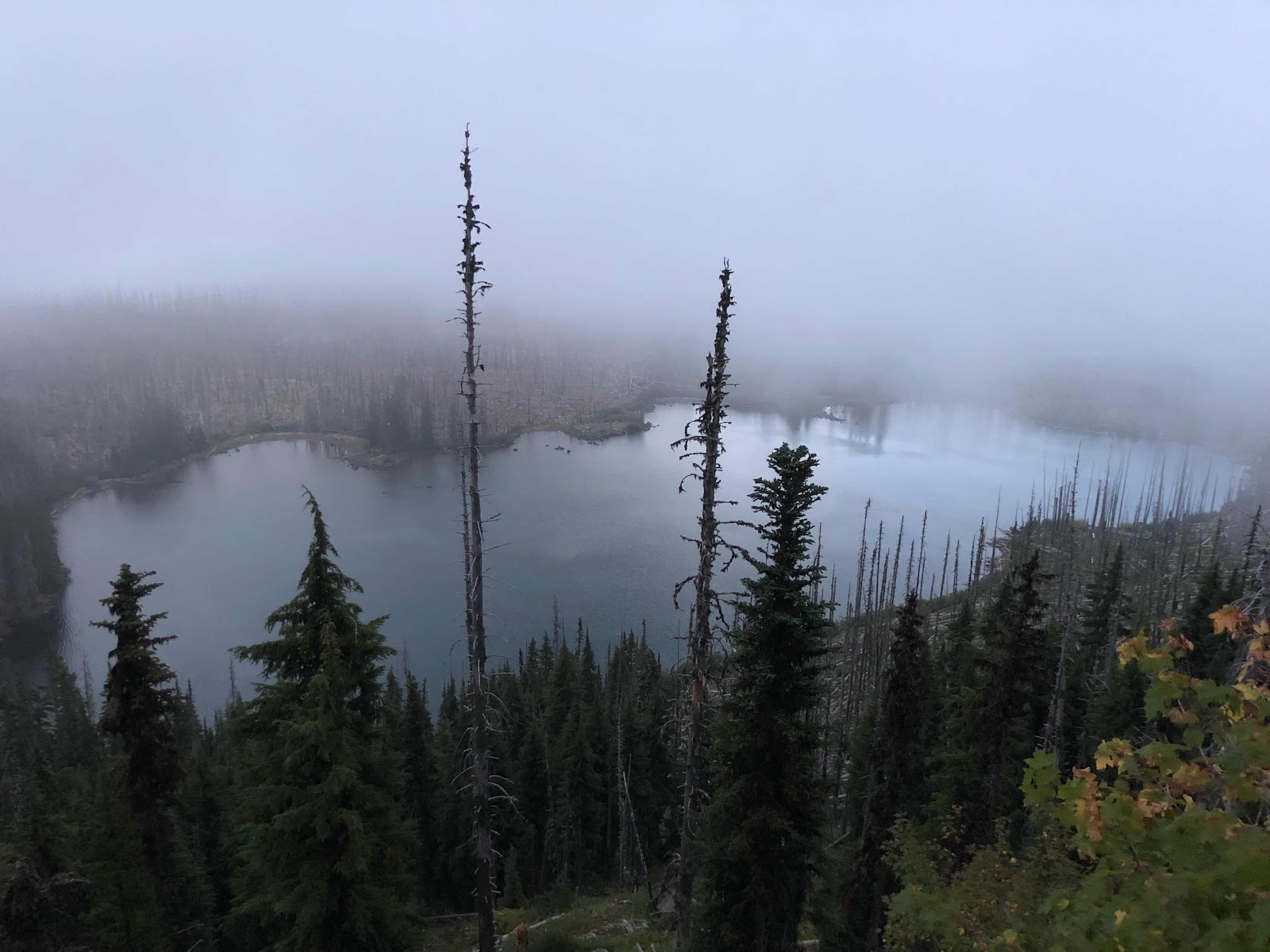
Throughout the morning I drew nearer and nearer to Mt. Jefferson, able to enjoy its beauty in the clear air. As the clouds started to clear out in the sun, I took in hours of truly blue sky, and far out views of the mountains I had left behind, which I had been unable to see thanks to the previous smoke haze.
 |
| It still took a little while for the sun to burn away all the clouds |
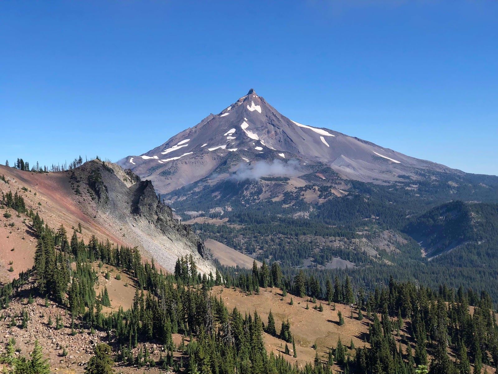 |
| Mount Jefferson in all its glory |

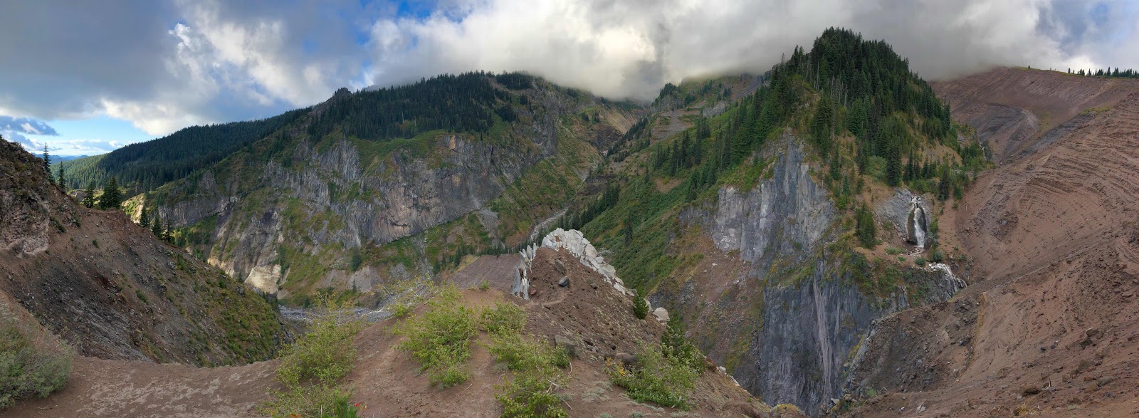
Macro caught up to me just in time for crossing Russell Creek, right on the edge of another charred burn area. As I approached the river, I covered my nose with my buff, asked Macro to see where the horse was so I could avoid looking at it, and headed to the river. Obviously once he pointed out where it was, I had to look, and it really wasn't so bad - only its backside was out of the water, so it mostly just resembled a moldy rock, except with a tail. I focused on finding my way across the fast-moving, milky, glacier-melt water, as it was one of the bigger river crossings we'd seen in some time, and avoided looking more closely. I refused to breathe through my nose until I had ascended the hill on the other side, so I don't know if it really was that smelly, but overall it was way less climactic than I made it out to be. (As is usually the case with anxiety).
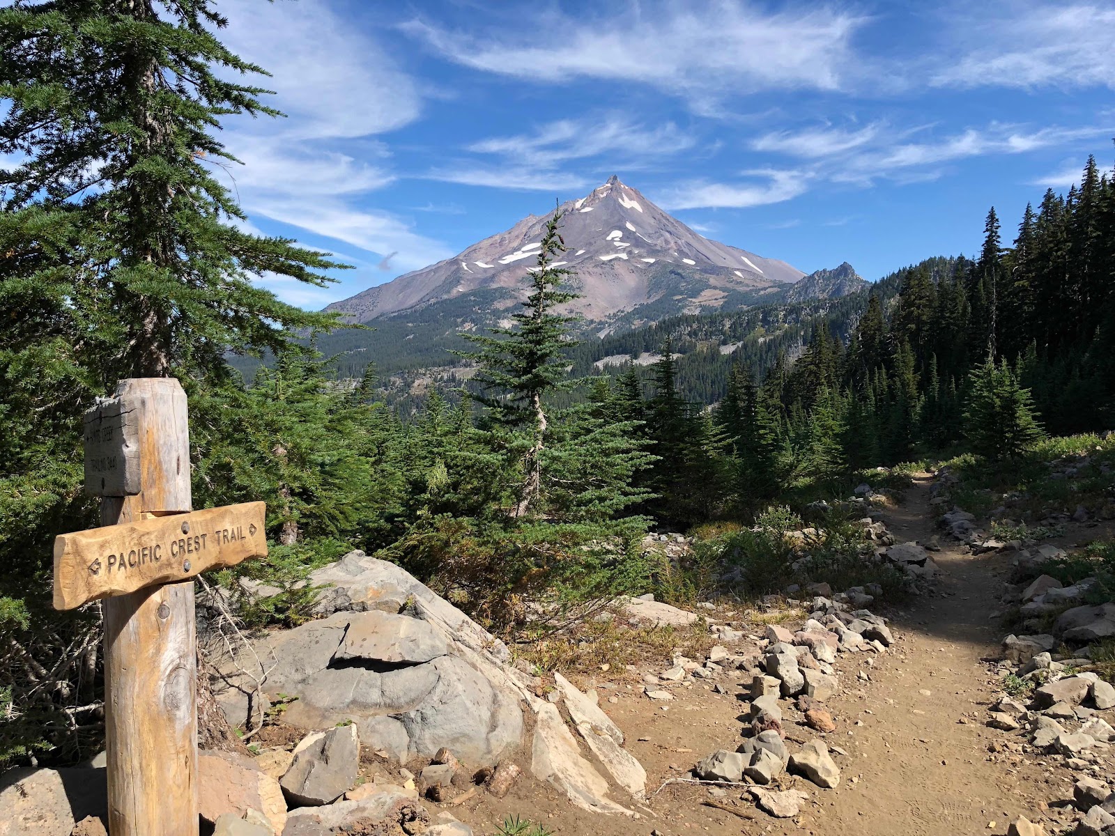
Macro and I hiked together for a bit after that, and eventually separated to go our own pace, planning to meet up in a few hours at a decided campsite. Throughout the day the trail had approached Mt. Jefferson, travelled around the peak, and at this point started to move away from, in the direction of the boundary for Mount Hood Wilderness. I felt a lot of excitement about approaching Mt. Hood, partially because it is Oregon's largest and most well-known mountain, and partially because Mt. Hood was our final major mountain before the Oregon-Washington border, and the final section of the PCT. I was also excited to be nearing the border because that's where my dad would be meeting me, in order to join me on trail for a bit. It had been about 5 months of living another life without seeing anyone from home, so I was excited to see my dad
and share a bit of this new life with him.
The last few hours of the day were spectacular and exhausting. As I hiked away from Mt. Jefferson, the sun was beginning to lower, creating striking shadows across the mountains and valleys. At one point I turned around to see the view behind me (always a good idea to remember to do this every now and then) and I had to stop dead to take in the breathtaking view of Mt. Jefferson, brightly illuminated in contrast to the grey shadows in the foreground.
|
| I had a hard time focusing on moving forward when I had this view behind me... |
The Mt. Hood Wilderness boundary is at the top of a high, exposed ridge. With the aid of some good music, I found a rhythm and happily got myself to the top of the ridge where I could see a stunning view of Mt. Jefferson behind, and all the way to my first view of Mt. Hood in the distance ahead. I celebrated for a moment, and then began my descent down into an exposed rocky bowl, hoping to find some trees soon, because we wouldn't be able to camp unless there was a way for Macro to set up his hammock.
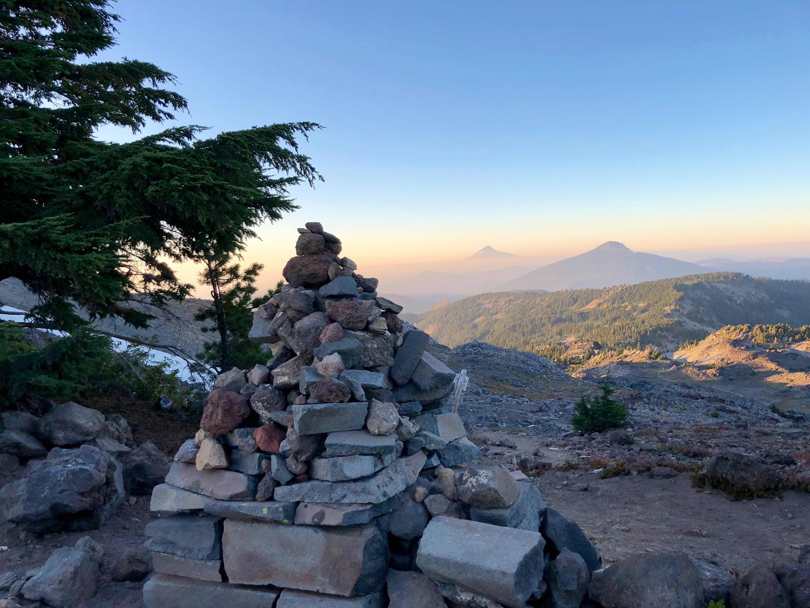 |
At the top, seeing Mount Hood in the distance for the first time, with a large cairn marking the wilderness boundary.
|
|
At this point I was pretty tired and a bit anxious about the descending darkness, but I also was in awe of the sky, one side of which was lit up by a beautiful sunset and the other with a gigantic full moon. The air had a cold bite to it, not to mention a gusty wind, and the temperature was falling pretty fast. I finally came up to a campsite that had adequate trees, next to a pond which was reflecting the huge moon. It was idyllic. There was a fairly large group of campers filling most of the flat, durable surfaces, but I was too tired to continue on so I managed to squeeze myself into a relatively flat spot, after which I admired the night until I got too tired and cold, so made myself a quick dinner in my vestibule and cozied down for another windy night, warm in my sleeping bag.
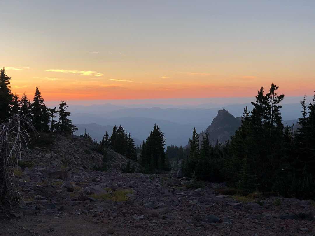 |
| Another spectacular sunset... you just don't get sick of these! |
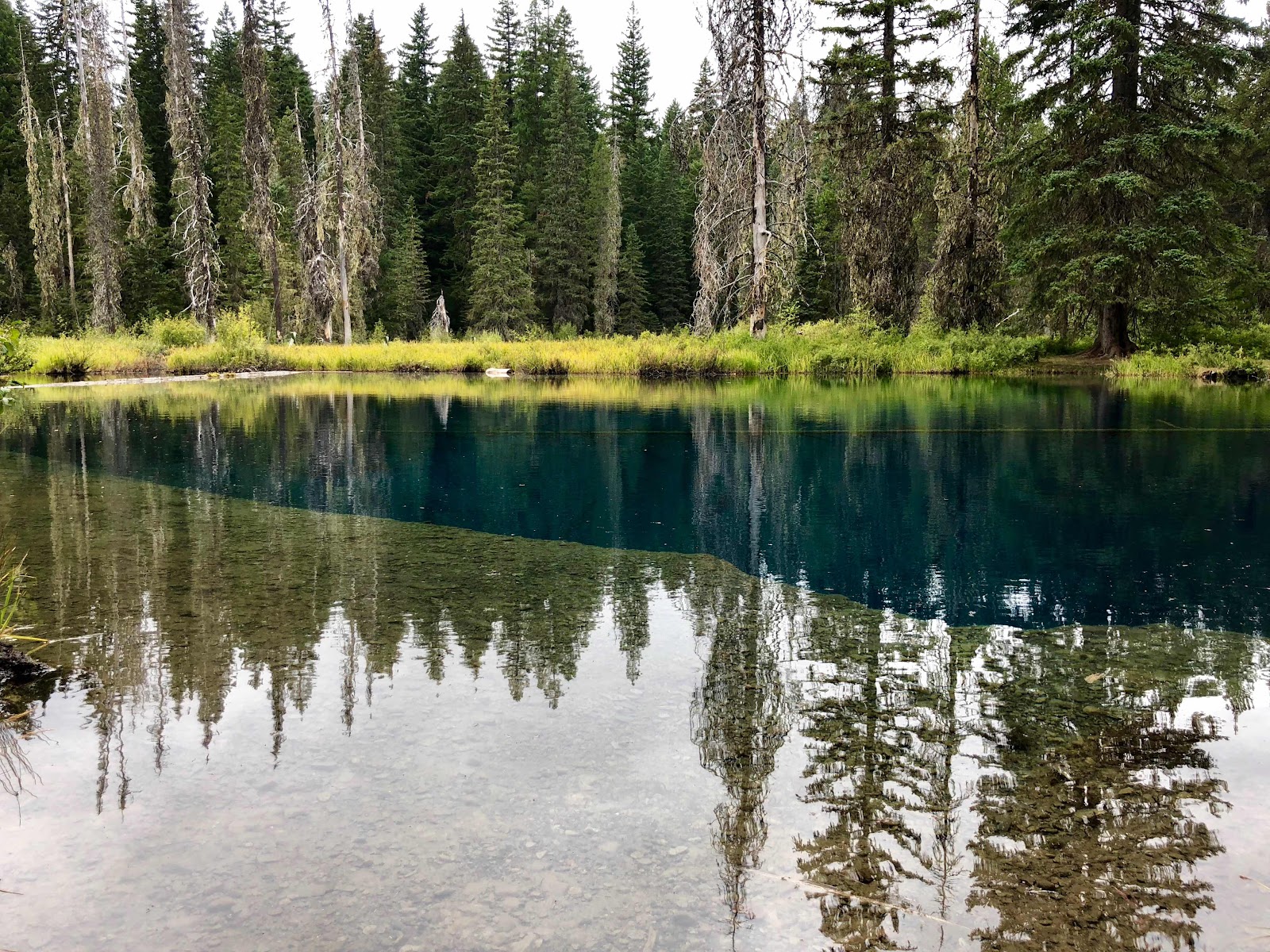
The next couple days continued to be smoke-free, a bit chilly, and occasionally rainy/foggy. We took a brief snack break at Ollalie Lake, so we could enjoy some store-bought coffee and treats, and then continued on our way. We hiked through the Warm Springs Reservation (of the Tenino, Wasco, and Paiute tribes, who were the First Peoples living in these regions) and alongside Timothy Lake. We also took an awesome snack break at Little Crater Lake, a deep, crystal clear, spring-fed lake named after the larger Crater Lake, due to its equally brilliant blue water. The tiny lake is deep, bright blue, and crystal clear, with the water always just above freezing temperature. Because of the overcast skies, I wasn't able to get a picture that really captured how dazzlingly blue and clear the water was, but believe me, it was
amazing.
 |
| An idyllic view from Ollalie Lake Resort |
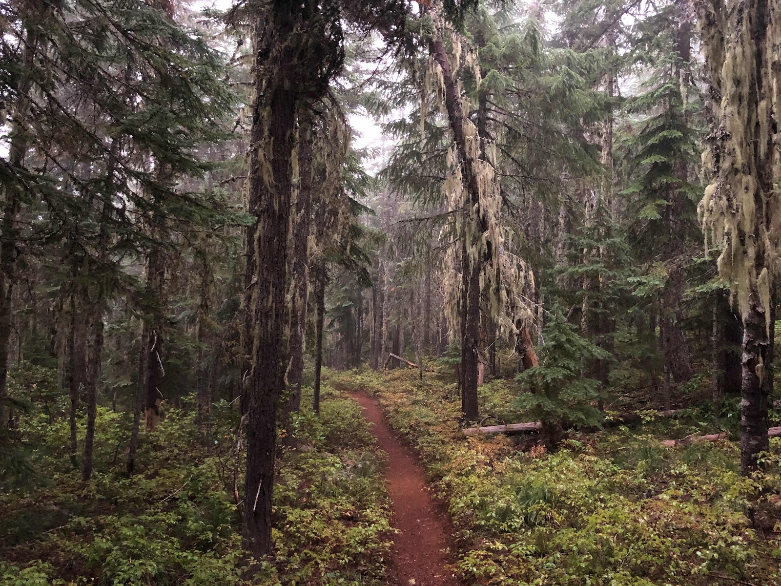 |
This is when Oregon started becoming the wet, mossy jungle I had imagined when I first hiked over the border.
|
|
 |
| The drastically steep edge of Little Crater Lake |
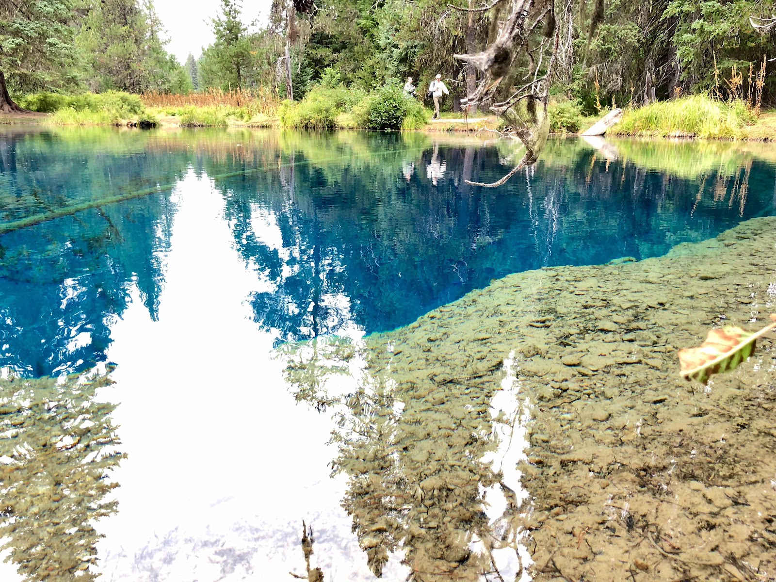 |
| This bright photo kind of gives as idea of what the blue colour looked like, but alas, still doesn't do it justice. |
Finally the day came in which Macro and I would be getting to Timberline Lodge - a fancy hotel & ski resort located on Mount Hood, well known to hikers for its delicious buffet. Macro and I planned to get to the lodge in time to gorge on the lunch buffet, rest for a few hours, and then hike out a few miles in the late afternoon. The day was cool and wet, I walked in and out of clouds and rain all morning, eventually hitting a long, sandy climb up to the lodge. At one point I saw what appeared to be a day hiker walking towards me on the trail, and something looked weird about him. I couldn't figure out what it was until he got closer and I was shocked to discover it was my dad! I pretty much lost it, hugging him and sobbing in joy and surprise. I can't really describe what was going on in my head at that point... I was shocked to see a face that felt like it was from another life, and after so much recent homesickness and stress, it was such a comfort to see someone who could connect me to home. My dad had arrived at Cascade Locks early and was doing some hiking in the area to get some practice in. He'd parked at the lodge and decided to hike in my direction, figuring he would camp with me and then head back to his car with me the next morning. He didn't expect me to be so close to the lodge, so in the end he joined Macro and I for a delicious lunch buffet, and then hiked out and camped with us that night, then headed back to the lodge on his own the next morning. Macro and I hiked in the opposite direction towards Cascade Locks, where I would meet my dad again the following day.
It was a weird experience to have someone from home there on trail with me, after so many months feeling so far away from home, literally and figuratively. He had done lots of preparation for his hike, but I also found it funny and endearing to see all his unnecessary gear - he obviously needed someone to give him a pack shakedown, like everyone did at Scout and Frodo's house in San Diego, before hitting the trail. Thru-hikers can be unbearably smug about their knowledge of hiking necessities and ultra-light gear, and I couldn't help but be a little amused by some of his items... (Why would anyone buy an actual water bottle when you can just re-use a SmartWater bottle over and over again?) I was, however, quite jealous of his brand new Big Agnes Copper Spur 2 Platinum tent, which is now on my wish list.
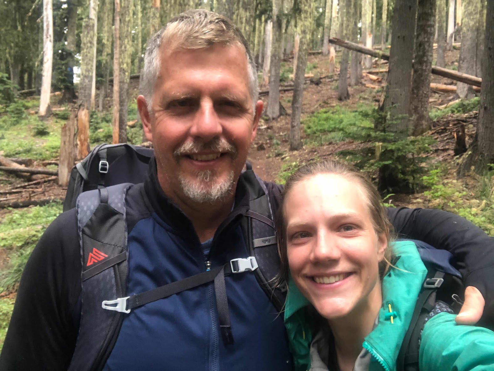 |
| Excited selfie after my dad surprised me on trail!! |
 |
| On the way to Timberline Lodge with Dad |
 |
| Finally got myself a cameraman!! |
 |
| A slightly disconcerting section of trail on Mount Hood... What exactly am I walking into here? |
 |
| Some views after leaving Timberline Lodge and hiking along the side of Mount Hood |
The next day, my final full day in Oregon, I took a small alternate to see Ramona Falls, and thoroughly enjoyed hiking alone through a cool valley between two high rock walls, back to the PCT. I was singing very loudly to myself, assuming no one would be around since it was an alternate, until I turned a corner and saw a woman eating her breakfast in her hammock. That was awkward, I was really belting it, but luckily she was a good sport about it. :P
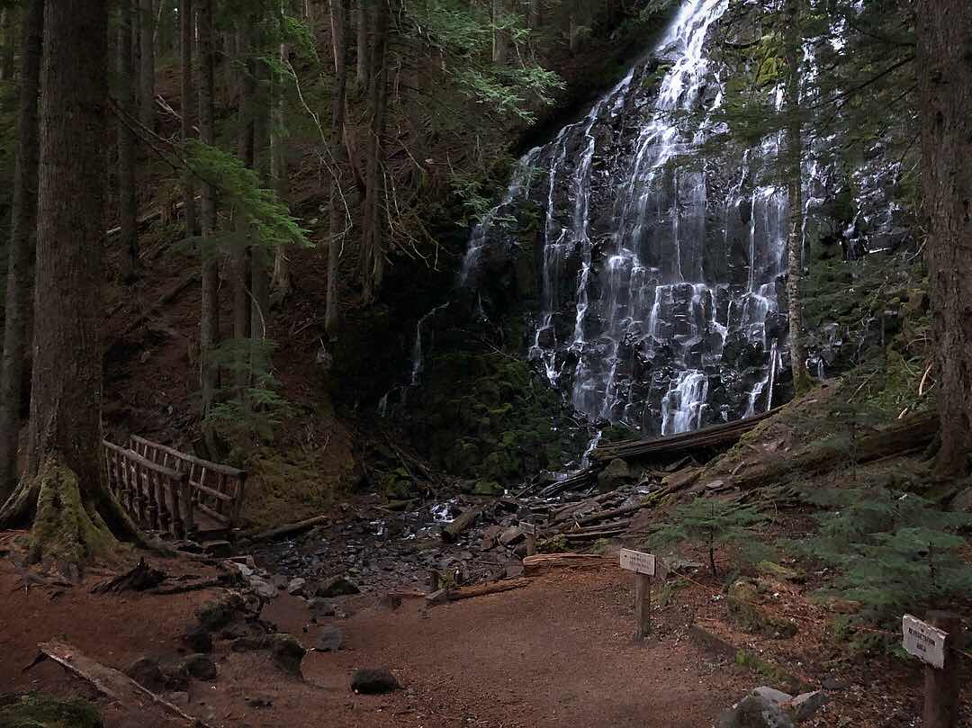 |
| Ramona Falls |
I spent some time that day hiking with a few hiker friends I hadn't seen in awhile, saw my first views of Mount Adams and Mount St. Helens (I was
really excited about seeing St. Helens, after having heard so much about its notorious 1980 eruption), and then camped by a big lake and enjoyed my dinner while laughing with some fellow hikers, swapping poop stories (as you know, I had a new one that was pretty good), and sharing in our excitement to be reaching the border the next day.
 |
Finally meeting the other "Patches" I'd been hearing about since early on in my hike. I had hiked with his friend for awhile and been lovingly dubbed "Fake Patches". I maintained I was named super early and was therefore the original Patches, but as it turns out, THIS Patches was named first, so I am indeed Fake Patches.
|
|
Finally, the next day, I hiked my last miles in Oregon. The state border is located in the Columbia Gorge, a huge canyon carved out by the Columbia River, with the town of Cascade Locks, Oregon on one side of the river, and Stevenson, Washington on the other. It's the point of lowest elevation on the PCT, and it requires a fairly long and steep descent to get there. Cascade Locks is the only "incorporated town" that the trail goes right through, and it was my rest stop for a couple days before beginning the last leg of the hike. Many years ago, there used to be a huge natural land bridge across the gorge, known by the First Peoples of the area as The Bridge of the Gods. It collapsed and created a temporary natural dam and the Cascade Rapids, which the original locks were developed to bypass. The rapids were eventually submerged due to a man-made dam in the area, and then a modern version of the land bridge was built to facilitate easy travel between Oregon and Washington states. The PCT goes directly across the newer Bridge of the Gods, crossing into Washington in the middle, before forking off the road and back up the other side of the gorge and onward to Canada!
 |
| Macro getting some shots of Columbia Gorge before continuing on the descent to Cascade Locks |
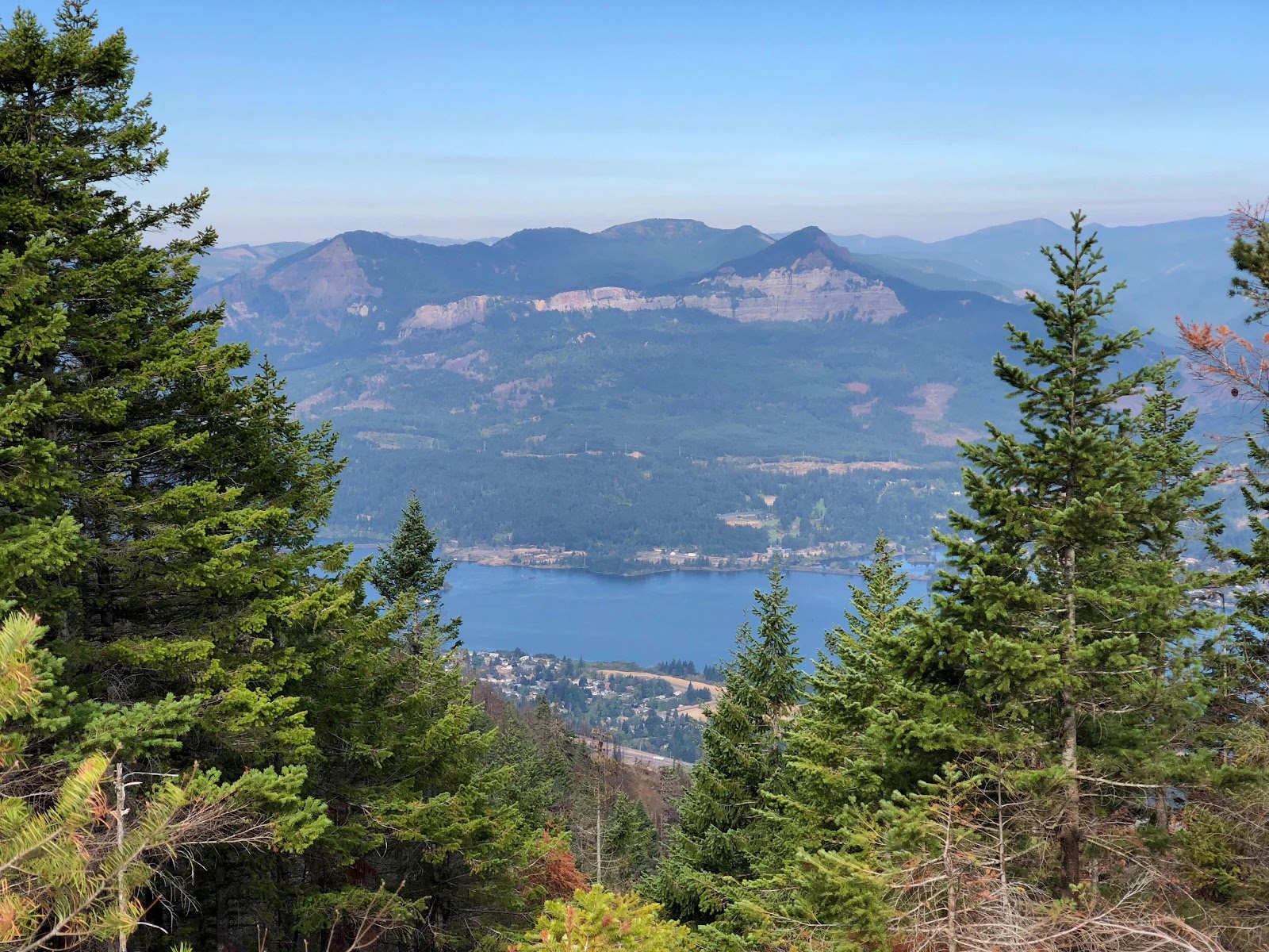 |
| Cascade Locks and the Columbia River, with Washington on the other side |


The Bridge of the Gods has an interesting story behind it. The First Peoples of the region, the Klickitat tribe, tell a story of how the Chief of the Gods had two sons, Pahto and Wy'east, who travelled to the Columbia River from the north to settle. The sons fought over the area, both wanting to live there, so their father settled the quarrel by shooting two arrows - one to the north and one to the south. Pahto settled in the direction of the arrow to the north, and Wy'east to the south. Their father build the Bridge of the Gods as a connector between the two brothers. After some time, another quarrel erupted when the brothers both fell for the same beautiful woman, named Loowit, who could not decide between the two. They fought over her, resulting in destruction of the lands and settlements around them, including the violent collapse of the bridge their father had created for them. In punishment, their father struck them down and turned them to mountains where they fell. Pahto became what we now call Mount Adams, Wy'east became Mount Hood, and Loowit became Mount St. Helens.
Cascade Locks and the Bridge of the Gods has another story that was significant to me, as well. Many hikers like to complain about Cheryl Strayed, the author of the memoir, "Wild", and it's often considered bad form to admit if you're out there hiking because of the book. And don't even think about mentioning the movie. (To be clear, Reese Witherspoon has
not hiked the PCT, in fact the movie was not even filmed
on the PCT! Okay, carry on). The truth is, though, reading "Wild" had a significant impact on my desire to hike the PCT and, more importantly, my belief that such a thing could even be possible for a young woman to do alone. Of course, it takes a lot more than just reading the book to be able to do a thru-hike, and so I think what bothers hikers about "Wild" is having so many people suddenly think that they understand what such a hike is like and think that they can just up and do it without proper preparation. In reality, nobody is going to get far on the PCT having only read "Wild", so even if it is someone's inspiration, they definitely will have done a lot more research and preparation if they actually end up on the PCT in real life.
 |
Eating a celebratory ice cream from the very same restaurant that Cheryl Strayed bought her celebratory ice cream after ending her hike on the PCT in 1995
|
|
 |
These ice cream sizes are not for the faint of heart. But they are a dream for a thru-hiker!
|
|
People also like to hate on Cheryl Strayed because they think she pretends to have hiked the whole trail, when in reality she actually only hiked from Mohave to Cascade Locks, ith some major skips in the middle due to high snow. Cheryl Strayed has actually never said she hiked the entire PCT, and in her memoir, she is very clear that her intention never
was to hike the whole trail. She still did hike around 1000 miles, which is a
huge accomplishment, and nothing to be sniffed at, just because other people have hiked all 2650 miles. Furthermore, Cheryl Strayed hiked in 1995, only a couple years after the trail was officially completed. At that time, there were
way less people on trail, and virtually no females. There were no electronic apps to let you know if a future water source is dry, or help you figure out where you are on the map, and how far you have to go to find suitable camping. She spent weeks at a time hiking utterly alone, carrying super heavy gear, and coping with grief, heartbreak, and addiction, and she did it. Her triumphant end took place at the Bridge of the Gods, a place that took on meaning for her as the place she would lay to rest some of the pain she had been carrying after the passing of her mother, when she was only 22 years old. In reading that book years ago, the Bridge of the Gods took on some meaning for me too, and finally reaching it myself, after having walked the entire trail that Cheryl Strayed had walked and then some (2147 miles / 3455 km, to be exact)... well it felt significant. It felt like although I wasn't officially at
my end yet, I was really truly going to reach that end, and nothing was going to stop me.
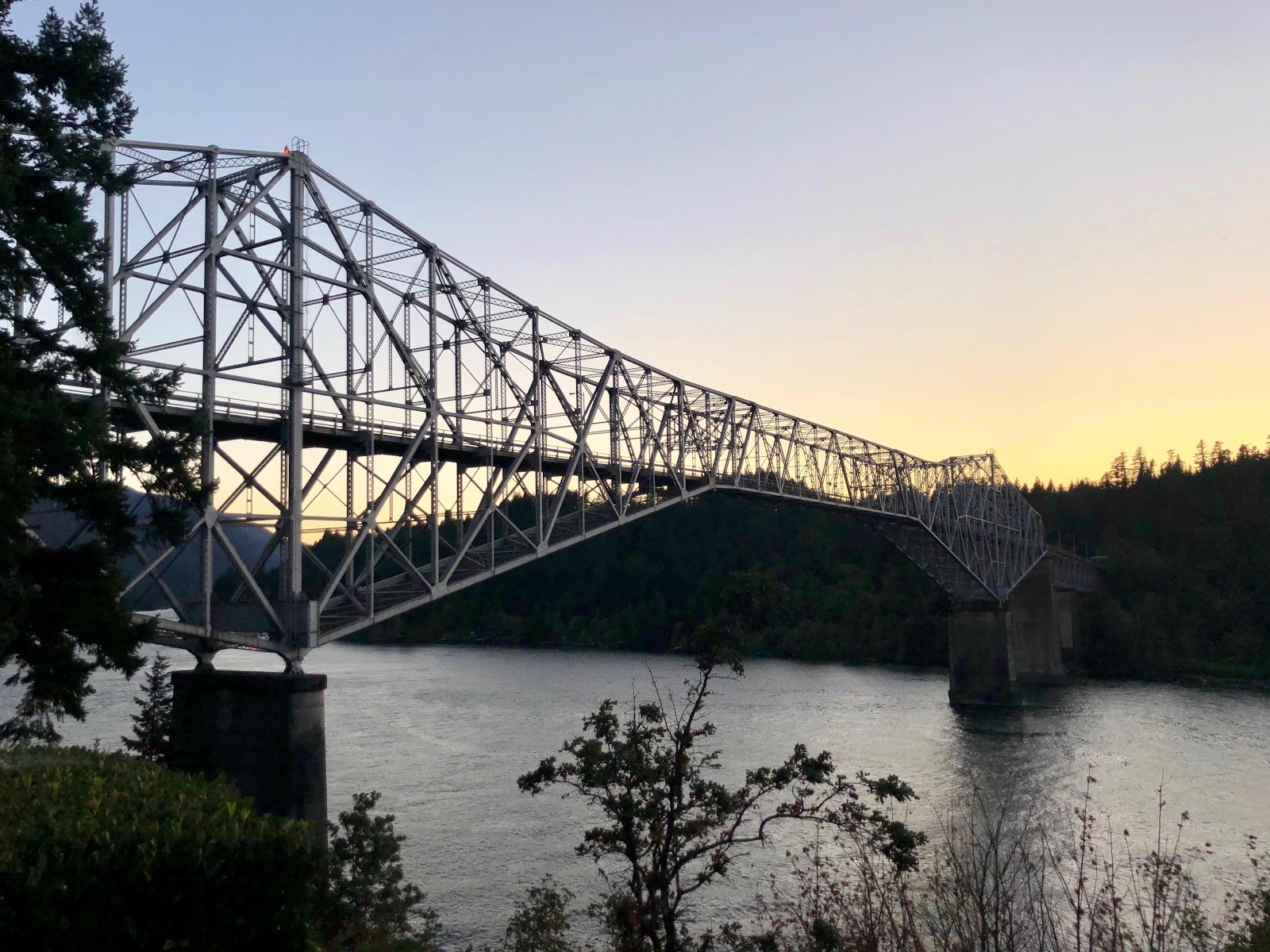 |
| The Bridge of the Gods (2.0) |
And with that, I arrived at the final section of my PCT thru-hike. I'd made it through 4/5ths of the trail and in about a month I would be reaching my final destination. But first, food, drinks, and a soft bed. Coming up next, my final (and favourite) state! Stay tuned!
Bye for now :)


Comments
Post a Comment