Washington Part 1 - Hiking with Dad

Hello to anyone who is still reading my sloooowwwwly progressing PCT blog! Sorry it's taken me so long to get my Washington posts done. I had them written ages ago, but due to procrastination, it took me months to get the photos uploaded. Thanks to my slowness, we are rapidly nearing the one year anniversary of my thru-hike, so I've decided to release my final posts in quick succession leading up to that date.
And so, without further ado, let's jump back in time, to August 30th, 2018...
I had just arrived at Cascade Locks, the final stop in Oregon before crossing the Bridge of the Gods into Washington, the final state of my PCT thru-hike. My dad drove us to Portland the next day for a full day of resupply chores. I updated my gear to prepare for potentially cold, rainy weather, and then I stocked up on copious amounts of lightweight, high-calorie (read: junk) food: oatmeal, clif bars, ramen, peanut butter, pasta sides, mac & cheese, tuna packets, chocolate, candy, trail mix, hot chocolate powder, and so forth.
I also made my dad go on a wild goose chase all over Portland in order to find a delicacy I had discovered on trail and wanted, no needed, to eat again before returning to Canada: Biscoff Cookie Butter. It is high in fat and has absolutely no nutritional value; therefore, a thru-hike is the only time I can imagine justifying such a purchase. And so, we went to 3 different specialty stores to find it, until I finally discovered it at Walmart. In my opinion, worth it. In my dad's opinion... possibly not.
I wanted some rest time, so I convinced my dad to take two zeros in Cascade Locks, and we decided to head back on trail on September 1st. Macro planned to stay in Portland for a few days to visit some friends and catch up with us soon. He's a faster hiker than I, plus I assumed I would be slowing down a bit to accommodate my dad having not hiked up and down mountains for the past 150 days. My dad, on the other hand, was concerned about slowing me down, knowing I had only a limited time to get to the border, due to both weather and the deadline of my 6 months allowed in the States without a visa. He told me to go at the pace I would have without him there, and if he couldn't keep up he would take a break and skip ahead to meet me later.
So Dad and I set off on the 1st of September, leaving our little hotel cabin at around 10:30am and immediately headed for the trail. We crossed the Bridge of the Gods in the bright morning sunshine, and just like that I had entered Washington - the third state and 5th and final section of the PCT.
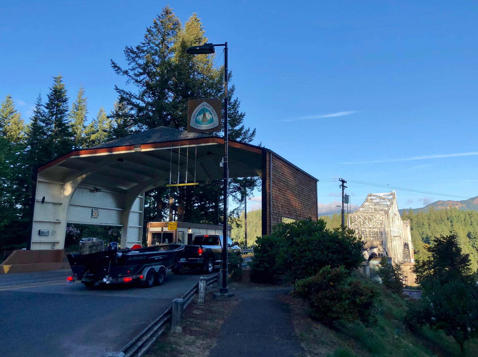 |
| The bridge entryway - you can see the PCT blaze just above, marking the bridge as the official trail. |
 |
| My last picture in Oregon |

It was a long climb out of the gorge followed by a long descent into yet another valley. The valley was filled with lush vegetation: plants with huge leaves, green moss, and deciduous trees. The light was bright, green, and almost tropical. It fit right in with what I expected hiking in a state known for its temperate rainforests. We were also gifted to some beautiful views at the top of our climb, including a vista in which I could see Mount Adams, Mount Ranier, and Mount St. Helens all at once.
My dad kicked some serious butt and hiked with me for 20.2 miles that day. In the evening we had a bit of a hard time finding a camp spot, finally stopping at a large flat area by a creek that already had quite a few people set up. By the time a couple more showed up, we had 10 tents crammed into the area. Unfortunately the group of people, all entirely new faces to me, weren't the most friendly. They had clearly been in a trail family for a while and didn't feel the need to interact with new friends, so they mostly ignored my dad and I while we prepared and ate our dinner. I was disappointed. I wanted my dad to see what it is like on trail, how you can meet someone and be good friends in minutes, or have really deep, real conversations with someone you just met. Instead, on his first day out, he was experiencing the cliquey side of thru hiking. I assured him most groups aren't that large or unfriendly, and luckily during the rest of his time with me we both got to meet a bunch of new people who were the warm, friendly, and generous souls I had grown accustomed to meeting on the trail.
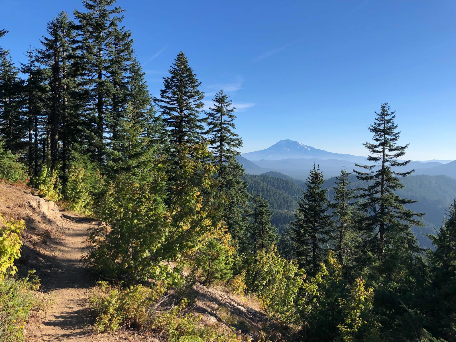 |
| Trail views |
The next day was much the same. I was very tired and struggled to keep up motivation until I decided to drop some caffeinated drops into my water at lunch. The rest of the day I barreled along with a newfound energy rush. All hail caffeine!
We had a 3.5 mile steep climb near the end of the day and, because I was on a roll, I left my dad behind to a slower pace, put my music on, and charged up the hill. (To sound like less of a jerk, may it be known that I did ask him if he minded first). It felt great to have a little time hiking by myself after spending the last 35 miles hiking with my dad. I really enjoyed his company and we always have great conversation (and nice silence too), but I had grown used to walking by myself in the months before this, and it felt strange to suddenly have another presence around so often while I hiked. It shifted my rhythm, and my ability to be fully present with myself and my surroundings. It was almost freeing to spend a few miles allowing myself to escape inside my own head, my music, the scenery, and the rhythms of my body, and to feel at one with myself in a way that I struggle to do in the presence of another person.
Of course, that doesn't mean it wasn't a huge pleasure to have my dad's company and to share the trail and long-distance hiking with him. After that climb, I waited for my him at a campsite, and eventually we were joined by some friendly hikers, including some familiar faces. That day we had hiked 18.4 miles, the next day we did 19.6. I was very impressed with my dad's stamina, I certainly wasn't doing that much mileage when I first started. And these weren't easy miles either! The steepness of the climbs had increased significantly since crossing into Washington and despite having regularly hiked near-30 mile days in Oregon, I found the terrain challenging enough to not want to be pushing any more than what we were doing.
The following evening, we ended up at a quiet blue lake nestled in the woods and roamed around looking for a campsite. The lake had designated camping spots up on a raised ridge, out of view from the trail. A loud, cold wind picked up throughout the evening and we saw only a couple hikers go by as we were filling up by the lake. By the time we settled in to eat our dinners and go to bed, there was an almost creepy feel to the area. Not being able to see anyone going by meant that we felt completely alone, and the howling wind added to the feeling. It was beautiful, but it was eerie. I was happy to snuggle into my warm sleeping bag that night and block out the wind.
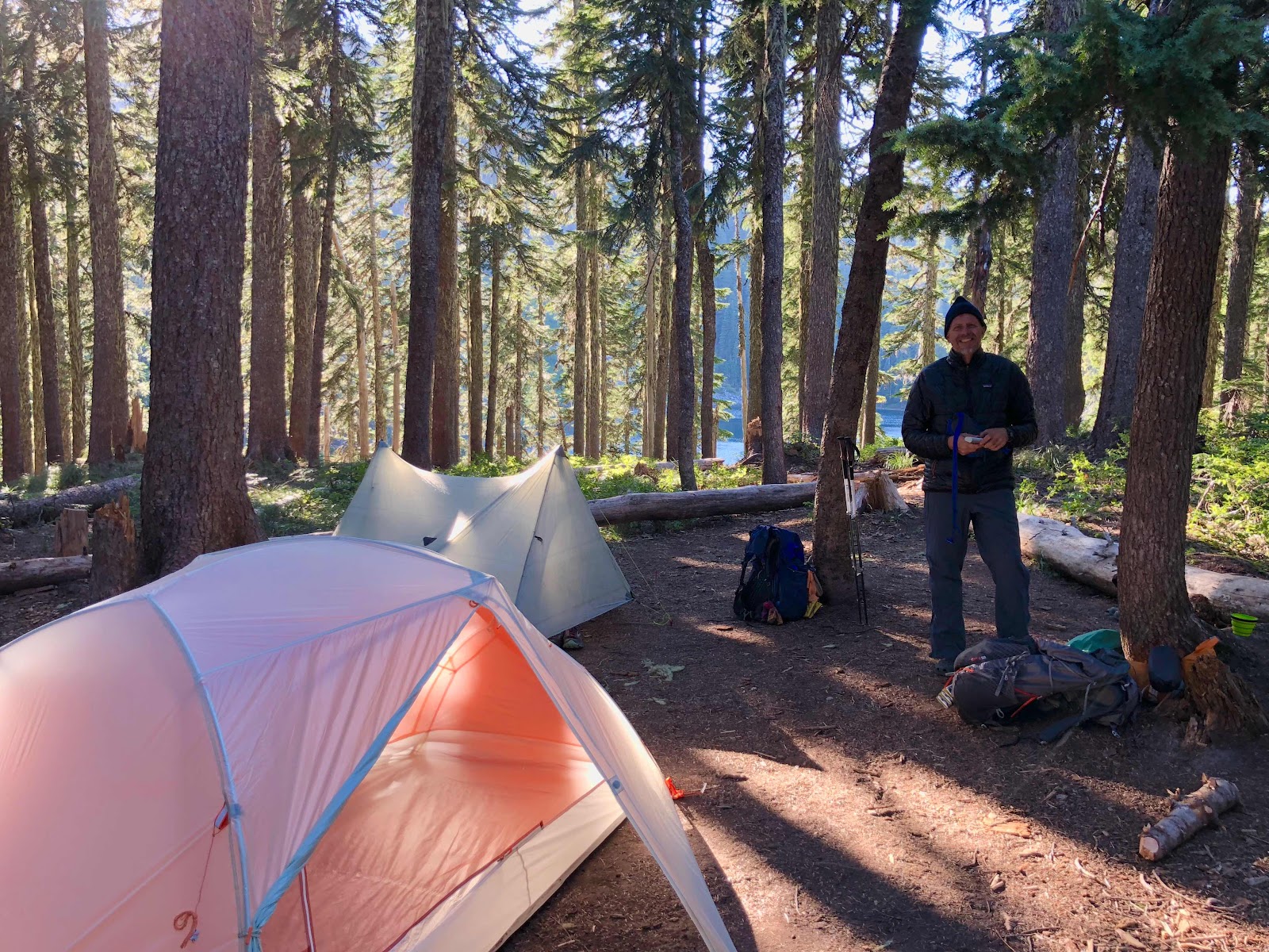 |
| Just finished putting our tents up |
The next morning we hiked a few miles to a trailhead by an empty dirt parking lot, where we decided to stop for lunch. In the trailhead register I discovered that Macro was suddenly ahead of us, and only by an hour or so!! It turned out he had passed the lake last night, but hadn't seen our tents and continued a few miles further. I needed my mid-morning snack so I decided not to push too hard to catch up, trusting I would eventually, so we sat down beside the parking lot, and ate while watching a very entertaining display of ground squirrels fighting over who was allowed to get closest to us in order to nab some snacks. (Spoiler... none of them got any snacks).
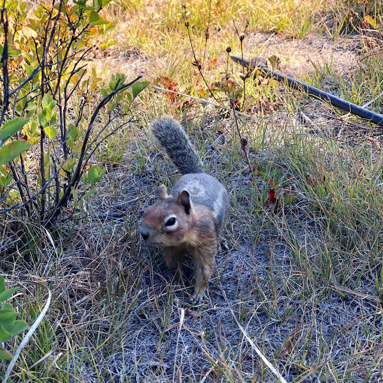 |
| The bravest of the ground squirrels |
Later that evening I took a few miles to do the end of the day climb on my own again with some motivating music. I remember noticing a lot more Cedar trees in the forest, which caused a magical change in colour and quality of the light. It was a happy, feel-good climb. My dad and I ended up in a small, circular meadow in the middle of the forest, where we pitched our tents for the night, only a few miles from the hitching point to Trout Lake, my dad's first official resupply stop.
The next morning we got up bright and early and rushed the 3 miles to the road, where we met a couple other hikers waiting for a car - any car - to drive by. Soon we were joined by more hikers, and shortly after that even more hikers. They were all new faces to me - I had evidently found myself in a whole new bubble. They were a jolly bunch, most of whom clearly had been hiking together for a while - Queso, Reverse Pigeon, Canadian Treasure, Flamingo, Pinecone, Medicine Man, Sharp Shooter, and Danger Zone, to name a few.
We all hung around while the minutes passed by but no cars did. It was one of my longer waits for a ride on trail - very few cars were driving by at all, and after getting up so early hoping to get into town for a nice coffee, restaurant breakfast, and relaxing resupply, it was frustrating to spend time sitting on the side of the road. It was also cold, although slowly warming as the sun rose. We resorted to various silly and superstitious activities attempting to summon cars.
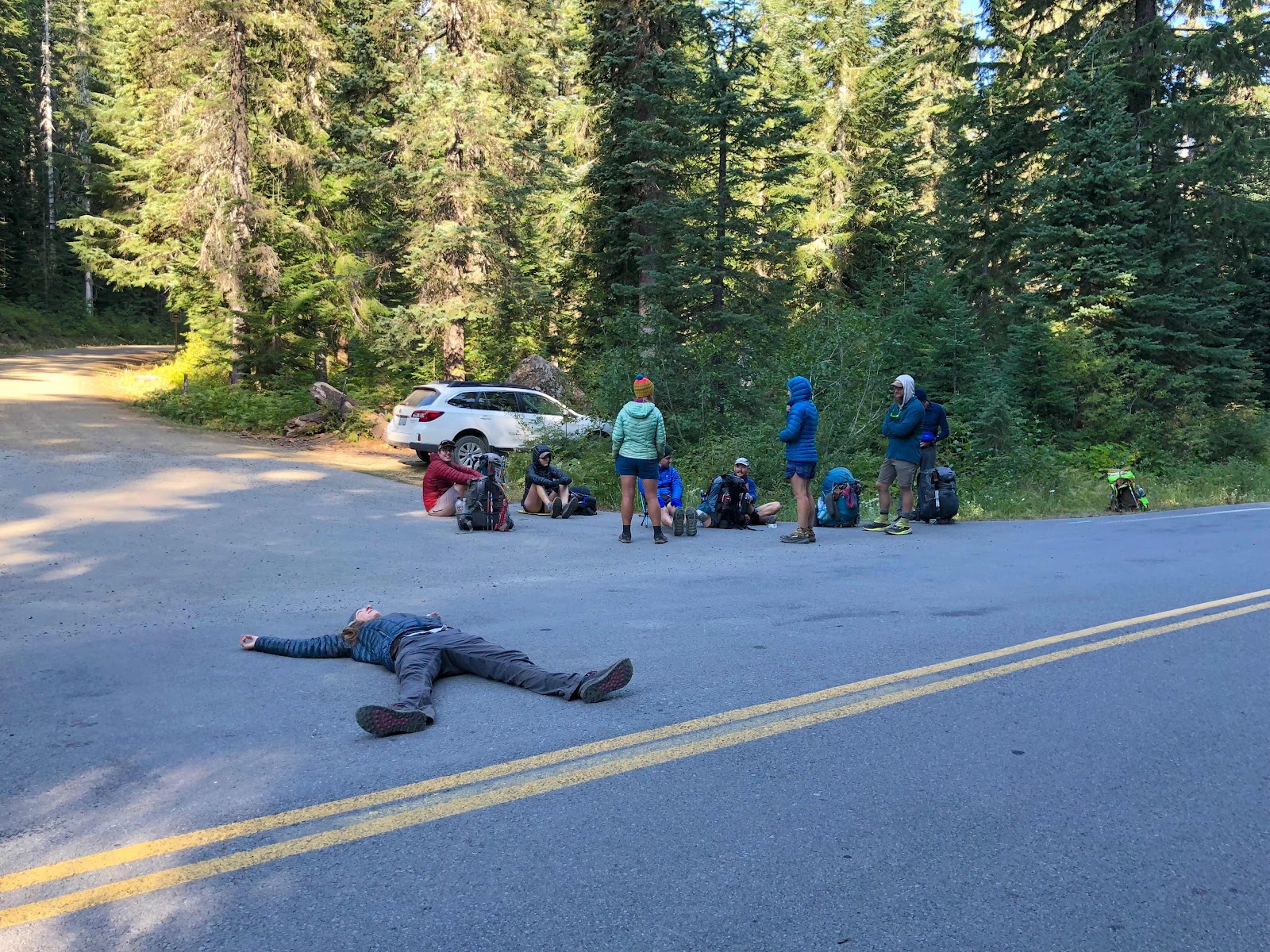 |
| Lying in the middle of the road is a hiker favourite for attracting cars. Don't try without supervision. |
Finally a car stopped and the first of us who had been waiting piled in for a ride to town. I had the most delicious banana pancakes and some sweet nectar of life (aka coffee) for breakfast at the local diner, and then my dad and I walked over to the general store to stock up on food for the next few days to White Pass. I insisted we had to try to get back on trail as soon as possible and get some good miles in. It was too close to the end for me to justify a 3 mile day and if we let ourselves get sucked into the town vortex, that would be our mileage. After taking some time to resupply and rest, we hitched a ride back to the trail and continued on our way.
Before too long, we were entering the Mount Adams Wilderness. Mount Adams (first known as Pahto or Klickitat), is a tall, glacier-covered mountain that stands out dramatically against the rolling, tree-covered hills at its flanks. It is the 2nd highest peak in the Washington Cascades (surpassed only by Mount Ranier to its north). The PCT traverses around the western side of the mountain, and provides some pretty stunning views of it's icy peaks. That evening we were gifted with a beautiful walk to Mt. Adams, where it stood out spectacularly from a base of burnt, dead trees. We were both pretty tired at this point (resupply days always do this) but managed a little over 10 miles, much of it along the base of the mountain, and eventually crossed a milky-grey river, rushing down from the glaciers above. We found a beautiful hidden camp spot with an incredible view of Mount Adams above us, slowly turning brilliant red in the sunset as we prepared our camp and settled in for dinner.
 |
| Enjoying views of Mt. Adams in the late afternoon light |
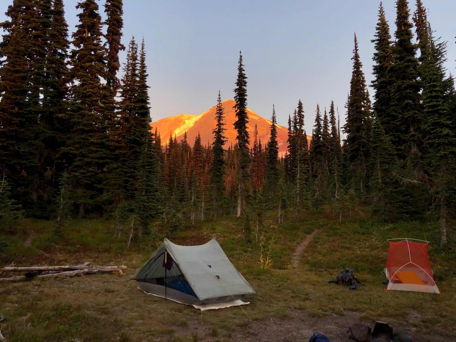 |
| Our campsite with the brilliant backdrop of Mt. Adams on fire with evening sunlight |
I took a few moments in the dimming light to find a cozy nook by the river and do a little meditation, which was wonderful. I focused on my breathing and the sound of the water for awhile, and then after that I opened my eyes and took in the serene beauty of the river. It was another one of those moments that filled me with gratitude and wonder and confirmed to me all the reasons I had wanted to do this challenging experience in the first place.
 |
| Glacier-melt river |
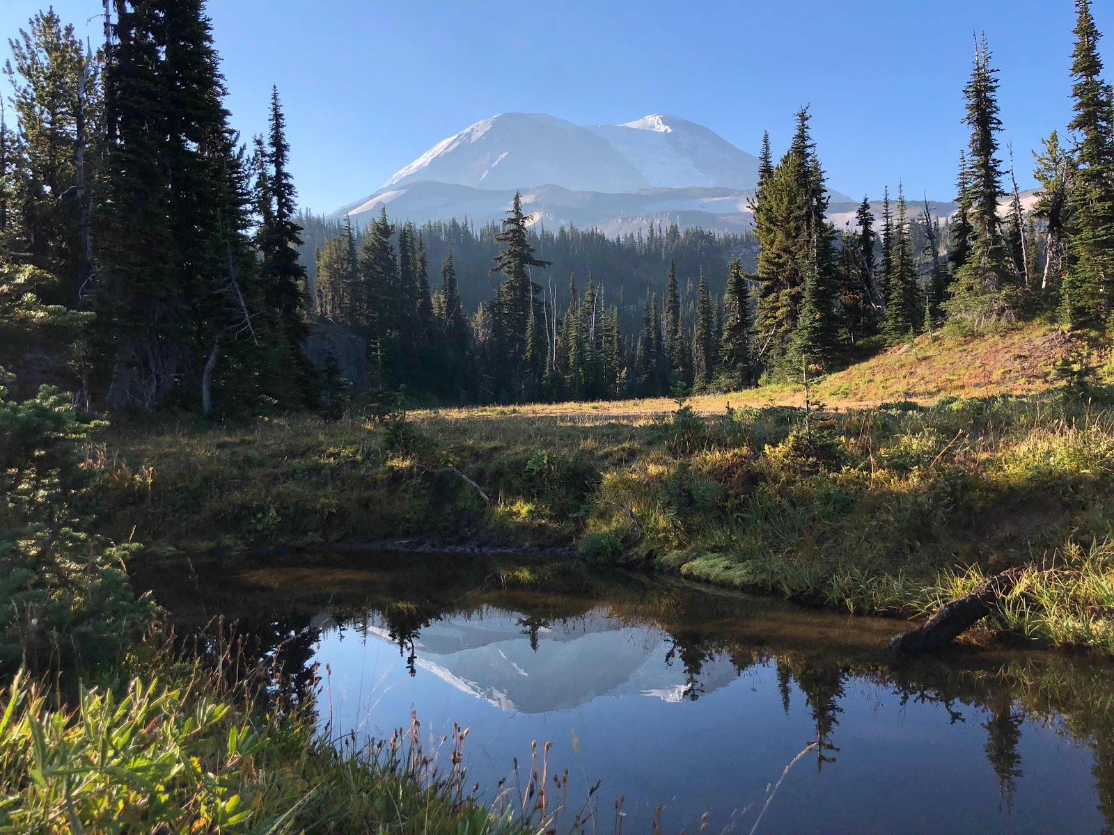
The next day was fairly uneventful. It was a long, tiring day of 21.6 miles (go Dad!). We slowly walked away from Mt. Adams and neared the Goat Rocks Wilderness. We crossed the wilderness boundary that evening and, struggling to find a campsite that didn't require even more hiking, we settled on a random clearing that almost could have been considered flat, but simply wasn't. Luckily for me, I was pretty used to sleeping in a wide range of places by this point, so after a nice dinner with some good conversation, I went to my bed, made sure my head was at the higher end, and settled in for a night of constantly slipping towards the side wall of the tent.
 |
| Early morning view of Mt. Adams |
 |
| Mt. Adams is just a really pretty mountain, okay? |
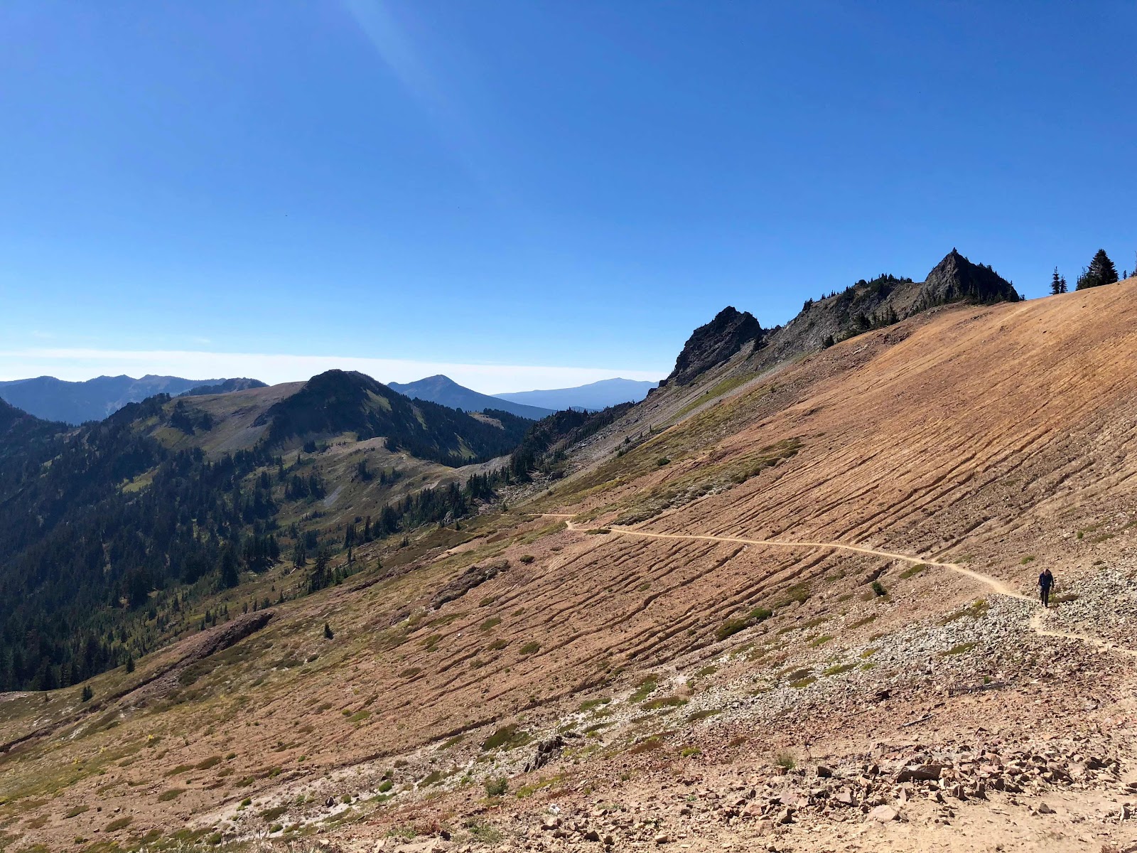
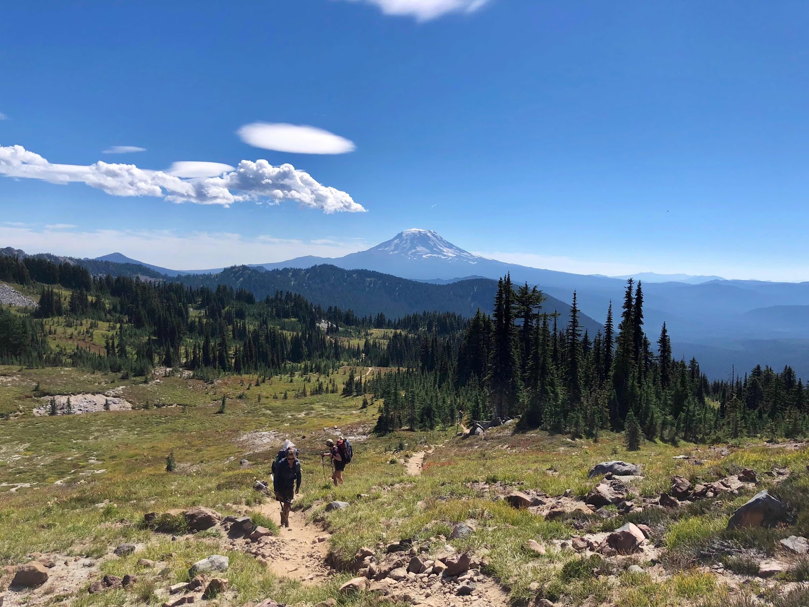
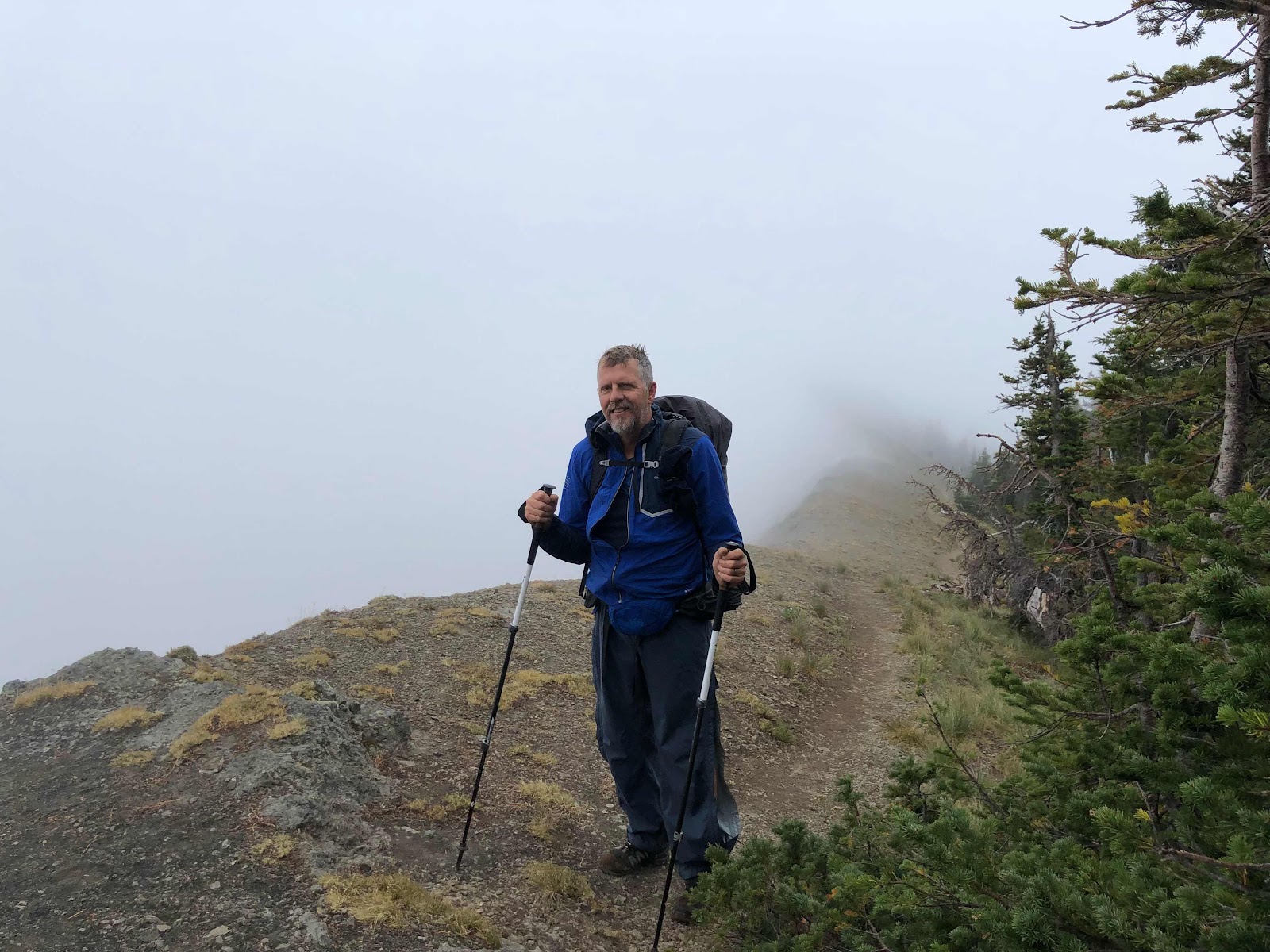
The next day was finally time for the beautiful, unique, and at times formidable hiking through Goat Rocks. In the morning, a long, steady uphill climb brought us to more excellent views of Mt. Adam's behind us, and an exciting view of Cispus Basin ahead of us, a huge expanse of colourful plants and rocks opening up to a wide, glacial valley below. We walked along the basin to Cispuss Pass, crossing in and out of the Yakama Reservation in the process (this whole area being the traditional territory of the Yakama Nation).
 |
| More views of Mt. Adams from a distance |
 |
| A full panorama of the views behind me... it was hard to look where I was going! |
 |
| Dad making his way towards Cispus Pass |
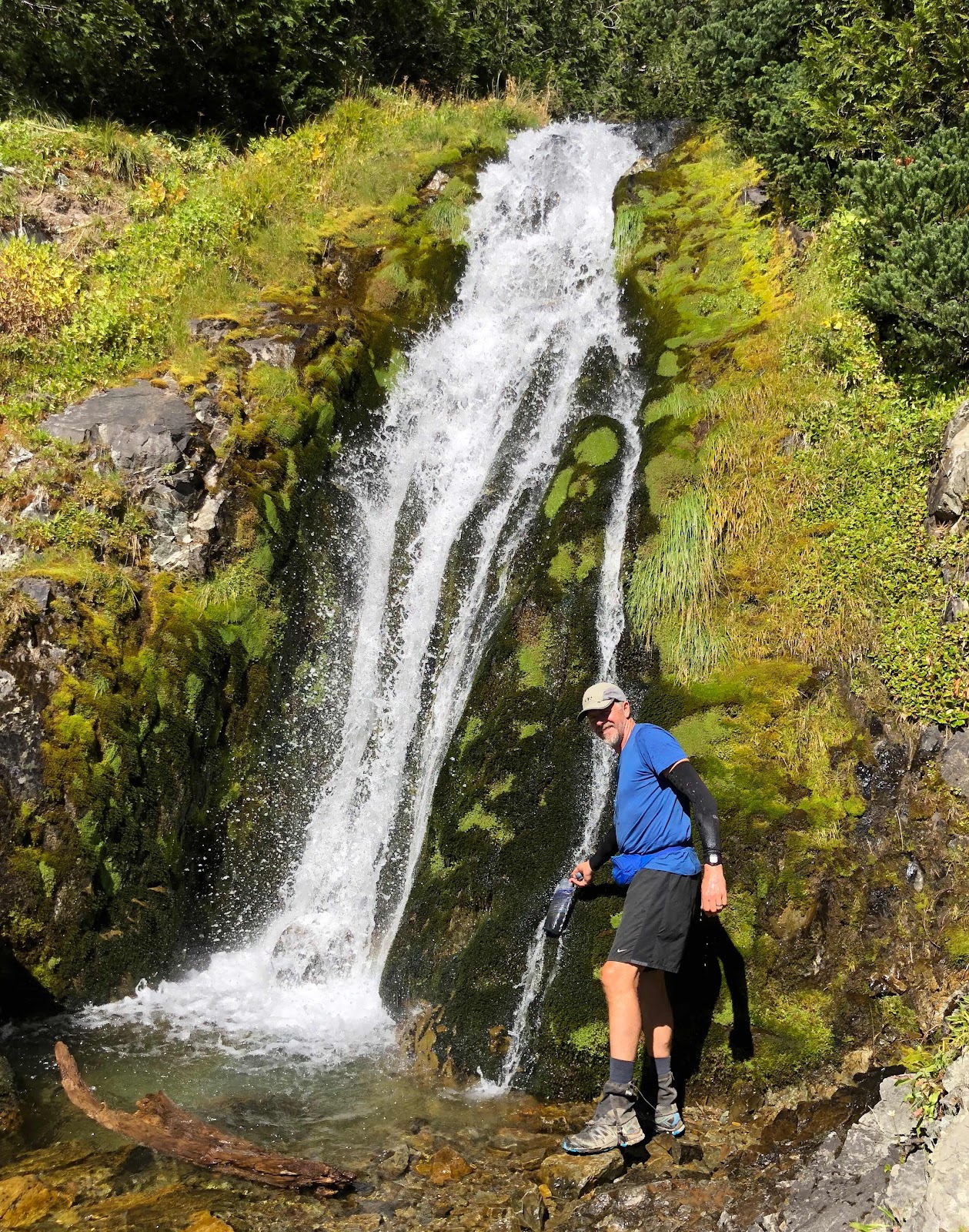
The rest of the day revealed spectacular view after spectacular view. We slowly climbed higher and higher, enjoying iconic views of the Goat Rocks Massif; trickling rivers surrounded by Truffla Tree plants (also known as the seed head of the Western Pasque Flower); a waterfall surrounded by bright green moss; and wide-open spaces showcasing dramatic, snow-covered peaks. We even saw goats! We also saw our first views of Mount Rainier, Washington's highest peak. It was dark in the distance where the peak stood out among stormy clouds and a topping of lenticular clouds. To me, it resembled Mount Doom, of Lord of the Rings fame, beautiful, dark, and foreboding, and yet the very direction in which we were heading.
 |
| This field was full of Truffula Tree plants. I do not get sick of how adorable they are. |
 |
| Filling up before more climbing |
 | ||
Goat Rocks
|
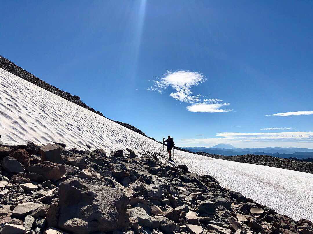 |
| Dad travelling across one of the little snowfields in Goat Rocks |
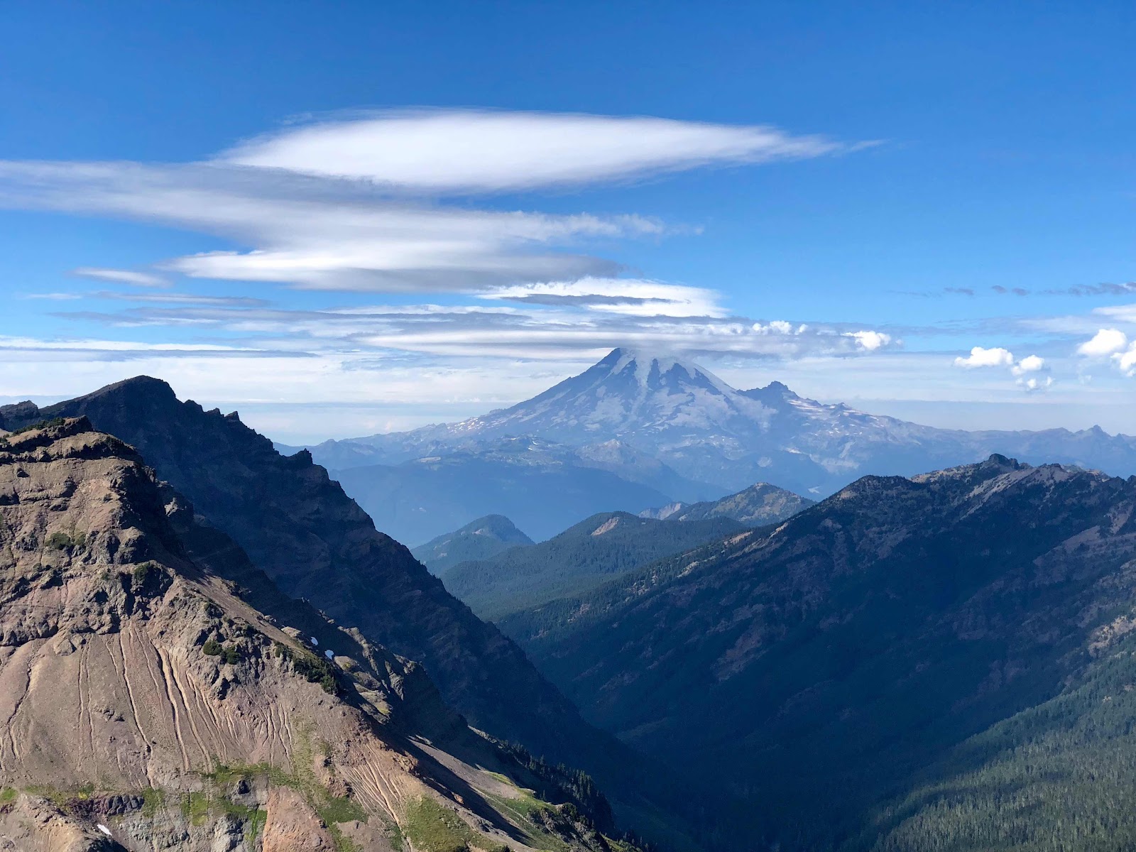 |
| First views of Mt. Rainier |
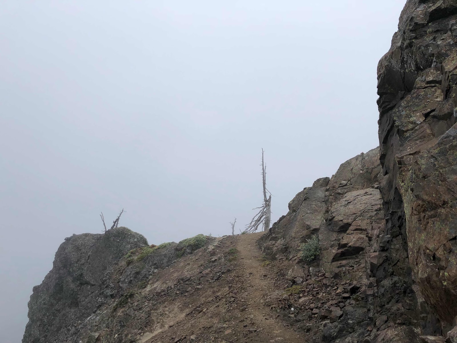
Not one to eschew a challenge, I informed my dad that we would be taking the higher, non-horse-approved alternate that climbs up onto a meandering path along the craggy spines near the peak of Old Snowy, on a path made of what can only be described as rock shards. Honestly, it was sketchy. Super fascinating and beautiful and exciting, but also sketchy. The flat broken rock slabs we were walking on frequently moved directly beneath our feet, making each step unsteady and unpredictable, and each side of the narrow path involved a steep slope to more rock shards far below. It was worth it for the mix of beauty, fascination, adrenaline, and accomplishment, but I wouldn't recommend trying that route in foul weather. Some morbid part of me started to imagine how horrifying it would be if I brought my dad up there, only to watch him plummet to his death due to a wrong step on a sliding rock. (That did not happen, however, so we're all good).
 |
| Dad on his way down from the alternate, when I finally felt my footing was stable enough to take a picture |
We were so lucky to have a beautiful blue sky and only minimal smoke in one direction, although the wind picked up throughout the day, and clouds were forming by the second. As we neared the evening and still had a significant amount to hike along the Knife's Edge - an area where the trail follows the spine of the cliffs, exposed to the elements - I felt a sense of urgency to get to lower ground before we camped, in case a storm decided to roll in.
The path along the ridgeline was wonderful, it really is an spectacular place to hike, with amazing views of Ranier, Goat Rocks, the valleys below, and on this day, even a raging wildfire, complete with gigantic, tree-sized flames, and plumes of smoke billowing into the air. This fire was the reason we eventually had to veer off the ridge towards the left, into a different valley than the one the PCT is supposed to descend into, on an official fire alternate that would eventually take us to White Pass.
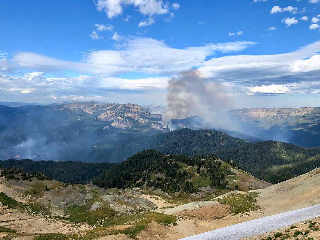 |
| Distant wildfire |
By the time we started descending on the alternate, my dad and I were both exhausted, sore, and so very ready to camp. The challenge here was that the alternate did not have official maps on my GPS app, meaning we didn't have camp spots plotted with accuracy, and instead had to go off people's approximations of the distances left on the comments. We knew there were some spots people had camped within a few miles along the alternate, but weren't sure exactly how many miles it was, nor how far we had gone at any given time, meaning we just had to keep on walking, as the air cooled, the wind blew, and the clouds darkened towards what appeared was going to be a rainy evening.
I suppose this was only a tiny taste of what it was like for the people who used to hike the PCT in the many years before GPS apps existed... needing to locate yourself and your distance solely based on landmarks and topography, and never quite knowing how far the next suitable camping spot would be. I deeply admire and respect all those that undertook (and still undertake today) any hiking that is not aided by the today's development and technology. It sounds like a noble, courageous challenge... which I also happen to have very little interest in trying.
Finally, blessedly, we trudged around a corner and came across a spot that was relatively flat and a durable enough surface to respect Leave No Trace principles. We also happened to come across some hiker friends, Canadian Treasure and Flamingo, beginning to set up their tents, and decided this was most definitely where we would be parking for the night. We were eventually joined by another fascinating hiker who is well known among the PCT Class of 2018 - 15 Foot. This interesting fellow had been hiking with 15 feet of garden hose wrapped around him, all the way from Mexico. If asked why, he usually responded with something along the lines of, "Oh I'm just bringing it to Canada...". I don't think any one ever learned what was driving 15 Foot to carry that hose to Canada, nor do I know if he even made it to Canada, but I do know that after months of hearing about the fabled hiker carrying 15 feet of garden hose, it felt a little like meeting a celebrity that evening.
It had been a long, challenging day, 19.5 miles of steep ups and downs, and some fairly technical footwork at times. "Thank you God for flat ground", I thought, as I readied myself for the night. I was more than a little excited to shovel down another delicious pasta side and then pass out in my warm sleeping bag. Just as I prepared myself to settle into my tent for the night, the rain started to fall.
The detour we had to continue on the rest of the way to White Pass was rumoured to be pretty gnarly. The comments on my GPS app showed many people complaining of its relentless steepness and lack of maintenance, most people saying that the one thing making up for it is the spectacular views. Unfortunately for my dad and I, our views were not quite so spectacular...
 |
| The majority of our view on the alternate |
 |
| Trail to nowhere... |
It was a cold, wet, relentless day. The misty clouds made way to rain, which eventually did clear enough for some pretty cool views, but the trail meandered up and down, then up, and then down, down, down, and then up again. Steeply, muddily, and with very little to look at to distract from the cold, stiff soreness that had developed thanks to the challenging climbing the day before. For my dad especially, this day was very rough. He'd been developing shin splints throughout the days previous (likely due to the relatively high mileage we had been doing, given the terrain and his only just getting on trail). This day of steep terrain pushed his pain over the edge, resulting in a lot of limping, soreness, and a need to slow down. While I was simply feeling tired and unmotivated (only the call of a resupply stop was enough to keep me pushing through the slog), my poor dad was pushing through the same tiredness coupled with severe pain, and worry about causing serious damage. Shin splints is not the kind of pain one is supposed to push through, as it can easily lead to a stress fracture, which is a much harder injury to heal.
 |
| A bit of view revealing itself beneath the clouds |
We did eventually make it to White Pass, a small mountain pass and ski area, which consisted of a convenience store / gas station that allowed hikers to mail resupply boxes there, and a ski lodge. My dad got us a room at the lodge while I picked up our resupply boxes, and then proceeded to the usual laundry, shower, phone charging, tent drying, food organizing routine of each "town" stop.
 |
| Nap and Bubbles, two new hiker friends, welcoming our arrival at White Pass |
My dad's pain had been high enough throughout our 15 miles on the alternate to White Pass that he decided it was likely unwise to head back out on trail with me the following day. He thought he might take a few days to rest, and then hitch ahead to my next resupply at Snoqualmie Pass, and hopefully head out with me again from there. Unfortunately, with all the pushing he had done in the past week, he needed more time for his shin splints to heal, and in the end wasn't able to join me again. I know it was a disappointment for him, but also I was extremely impressed with how well he had hiked over steep, challenging terrain, without having been hiking for months prior. I was tired and and felt challenged by the week behind us, and I'd been priming my body for 160 days at that point. In one week, my dad had hiked almost 150 miles and hadn't slowed me down once!! It was quite a feat. That being said, he needed to have been able to slow down and hike less mileage each day, in order to ease his body into the repetitive strain of hiking, and avoid the pain he encountered. Still, I am grateful he was willing to push and not slow me down, because in the end I finished my hike in exactly 6 months, and I am glad I was able to avoid the snow and cold that came shortly after I left the trail, as well as any issues with immigration due to my lack of visa. So, all in all... my dad ROCKS!!
That sums up the first leg of my hike in Washington state, accompanied by my super awesome dad, enjoying some pretty unique and beautiful parts of what the Cascade mountains have to offer. Stay tuned for more posts wrapping up the rest of my hike to Canada, ONE YEAR LATER!
Bye for now! :)

Comments
Post a Comment